It’s Day one of your much-anticipated road trip. All that planning and coordination is now behind you. You’ve looked forward to this trip for months. You’ve been on the road for only 30 minutes, and straight ahead of you, traffic control guide come to a complete stop in a construction zone. And your good vibes begin to deflate. Sound familiar?
You’ve hit that first unexpected bump in the road. Someone wise might remind us that what matters is the journey, not the destination, or encourage us to get out of the RV and chat with others also waiting there.
Another option is to acknowledge that Canada has only two seasons, winter and construction, and turn our thoughts to the construction workers’ work to improve roadways for everyone. Highways are more than just paved roads. They’re a testament to the hard work and dedication of the construction workers, engineers, and planners. Their efforts often go unnoticed, yet they’ve significantly impacted our lives, connecting communities, facilitating trade and communication, and enabling travel. Where would RV travel be if we didn’t have this feat of engineering beneath our wheels?
Some of the earliest constructed roads date back nearly 6000 years. Of course, the invention of the automobile in the late 19th and early 20th centuries paved the way – literally – for the roads we sometimes take for granted. The world’s second longest highway (7821 km) – the Trans-Canada Highway – was built between 1949 and 1970. The Macdonald-Cartier Freeway (Highway 401) segment that passes through Toronto is the busiest highway in North America and one of the widest. Ontario-based Highway 407 ETR, spanning 108 km from Burlington to Pickering, celebrated its 25th anniversary last year as the world’s first all-electronic, barrier-free toll road.
This past summer, my husband Martin and I travelled on three iconic Canadian highways: Alaska, Dempster, and Inuvik, and then to Tuktoyaktuk. Each offered a unique backstory beyond their asphalt, concrete, and gravel surfaces.
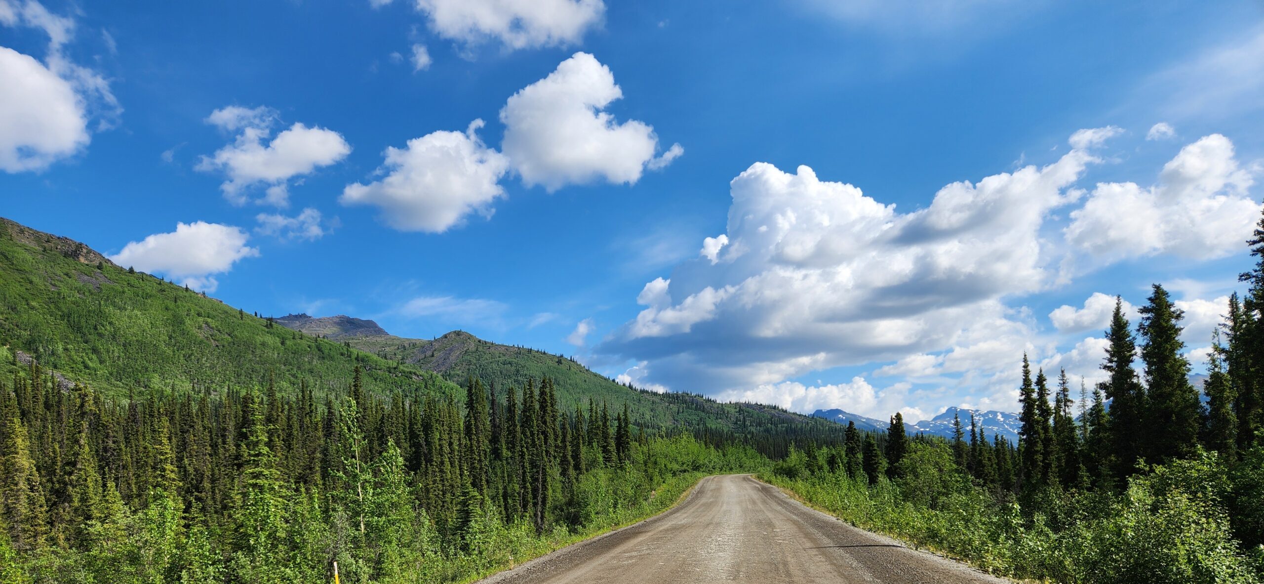
The Alaska Highway
Often, the first thing that comes to mind about the Alaska Highway is Johnny Horton’s song from the 1960 John Wayne movie North to Alaska. But the history of the Alaska Highway is more than that. The 1941 attack on Pearl Harbour led to both Canada and the USA agreeing to build an inland route. Unbelievably, it was finished in 9 months on November 20, 1942. Designed as a military route, it didn’t open to the public until 1948. More than 11,000 soldiers and engineers, 16,000 civilians, and 7,000 pieces of equipment were engaged in the construction of the highway from Dawson Creek, BC, to Delta Junction, Alaska, through subarctic weather, permafrost, thick forests, mountain ranges, equipment-swallowing bogs, mosquitoes, and grizzly bears. The highway was financed by the USA, and six months after the end of World War 11, the Canadian section was turned over to Canada, which (in partnership with BC and the Yukon) owns and maintains it today.
Initially 2700 kilometres long, the Alaska Highway has been reduced to 2232 kilometres as the roadway was retrofitted for safety and non-military traffic. As a result, you’ll notice the “milepost” highway markers along the route don’t jive with the actual distance of the highway. Because its focus was on the war effort, the construction of the highway did not pay attention to the environmental and social impacts on the communities it cut through. The George Johnson Museum and the Teslin Tlingit Heritage Centre in Teslin, Yukon, tell stories about the effects of the construction of the Alaska Highway on Indigenous communities.
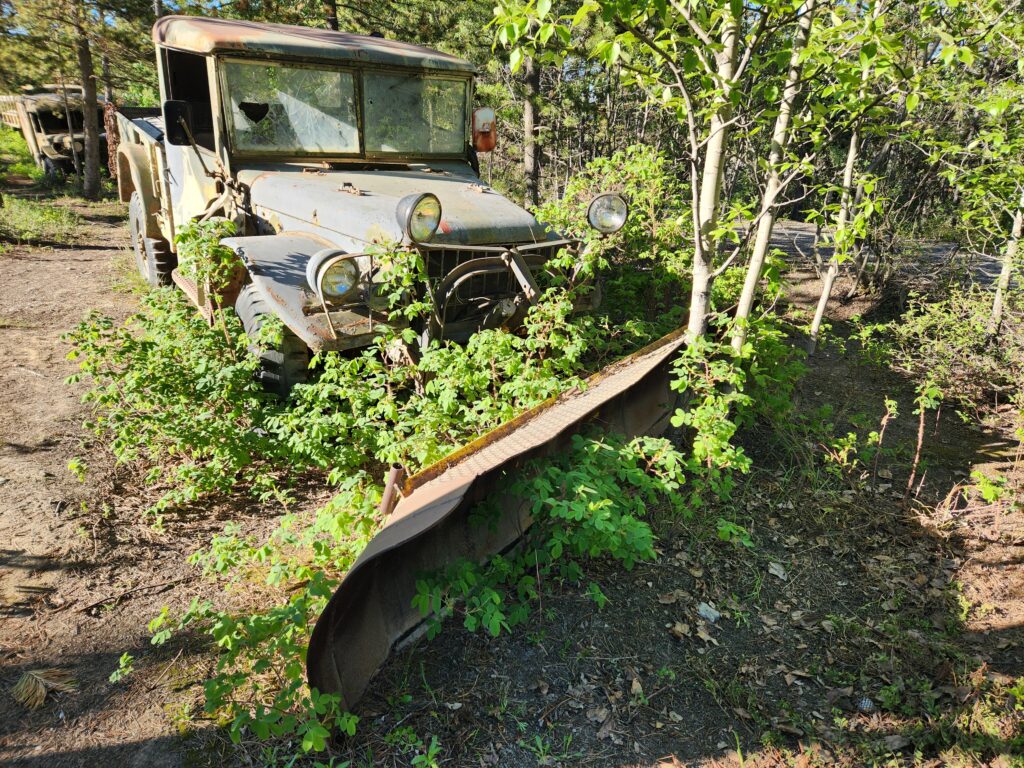
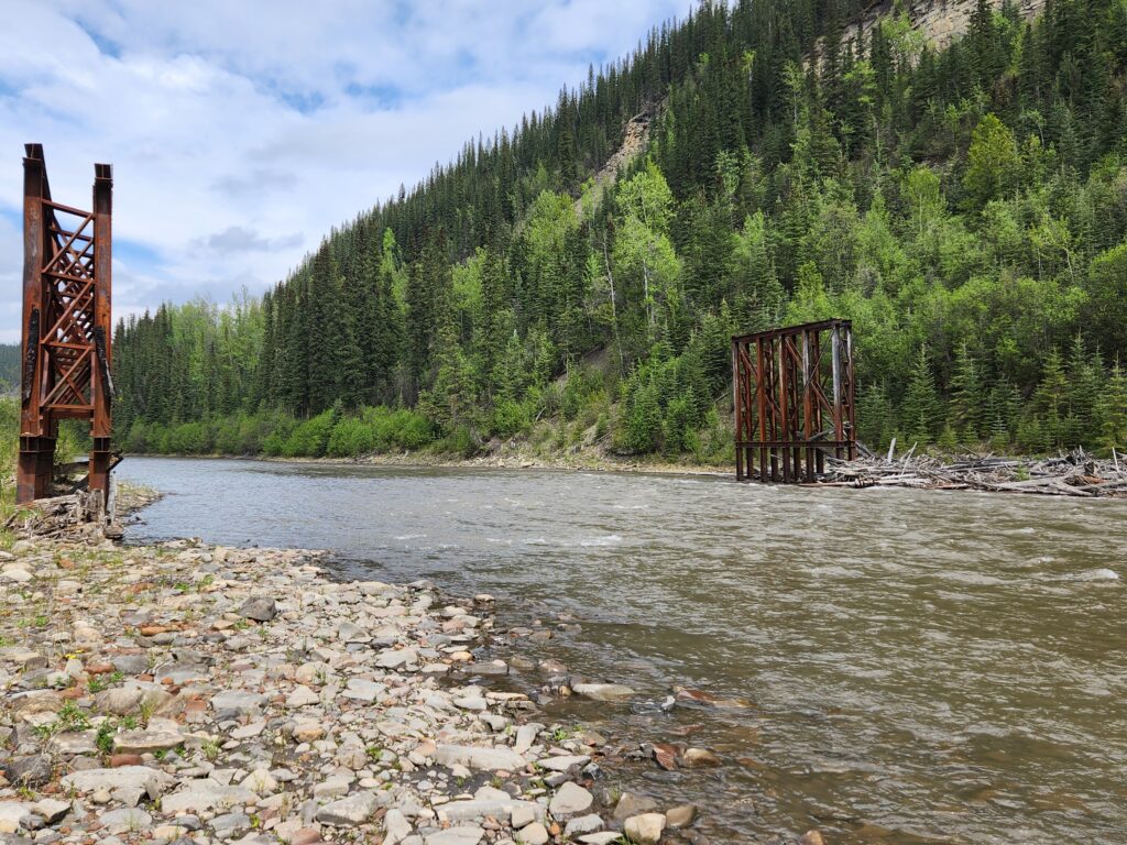
Even though more than one-third of the US Army soldiers working on the highway were African-American, they were assigned to 3 separate regiments and often provided with insufficient equipment, clothing and accommodation. Despite these hardships, the men of the 95th regiment bet their pay cheques that they could break all records in bridging the Sikanni Chief River at Mile 157. They won the bet: The Sikanni Chief River Bridge was not only the first bridge to be completed on the Alaska Highway but also took only 84 hours, half the time usually required for bridge construction. Recognition of this accomplishment is credited with the eventual integration of African-American soldiers into the US Army after the highway was completed. You can see some of the original bridge structure from the Sikanni River Campground & RV Park. Other reminders of the construction efforts dot the sides of the Alaska Highway even today, as the equipment was abandoned when the construction tasks were completed.
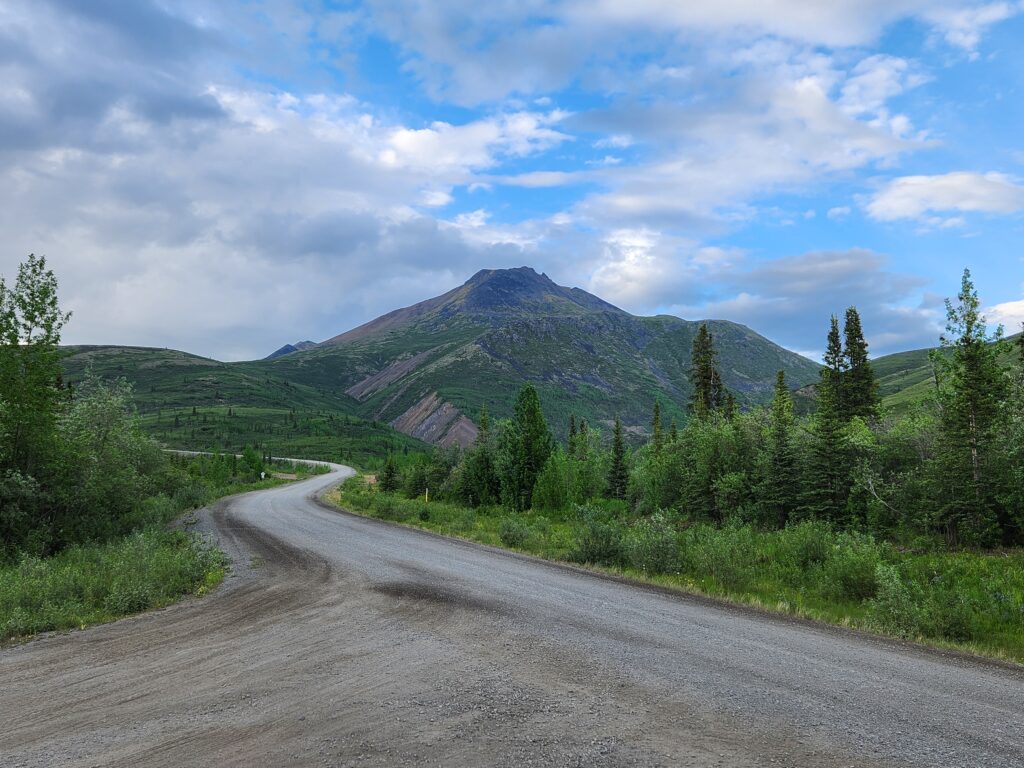
The Dempster Highway
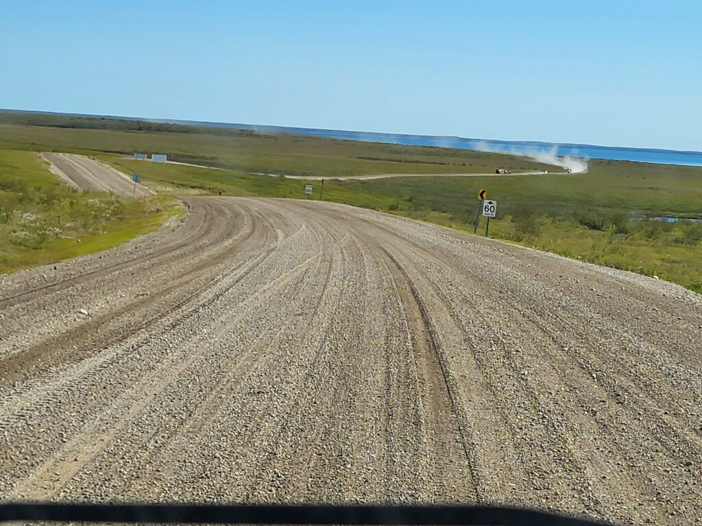
Dempster Highway is 736 kilometres long and, except for its first 5 kilometres, is all gravel. Initially built to support mineral exploration and development in the Yukon, it extends from Dawson City, Yukon, across the Arctic Circle to Inuvik, Northwest Territories, and passes through 10 of Canada’s 217 ecoregions. Construction took 20 years (without the benefit of an environmental assessment or land use planning) and officially opened in 1979.
A challenge with the construction and maintenance of the Dempster Highway is that good gravel is hard to find locally. You’ll see demarcations of different coloured road surfaces, indicating a different local source of gravel. In many sections of the highway, the sharp rocks easily puncture tires.
Inuvik to Tuktoyaktuk Highway
Also known as the ITH, the Inuvik to Tuktoyaktuk Highway is 140 kilometres long, taking you from Inuvik to the Arctic Ocean. It’s the first highway in Canada to reach the Arctic Ocean – connecting Canada from sea to sea to sea. Construction began in January 2014 and was completed from two directions, one crew working from the Inuvik side and the other working south from Tuktoyaktuk. It officially opened on November 15, 2017. As with the building of the Dempster Highway, most of the construction activities took place during the winter months. For the first 3 years, crews worked 24 hours daily, building eight bridges and 359 culverts. Geotextile fabric was placed between the existing ground and the construction materials along the highway to protect the permafrost.
The degradation of permafrost touches all areas of life in the North and beyond. The Dempster and Inuvik to Tuktoyaktuk Highways (as well as the northern section of the Alaska Highway) are built over permafrost. The thick layers of the rock and gravel roadbed are intended to prevent the permafrost from thawing. As the climate warms, keeping the permafrost intact under the roads is challenging, requiring intensive maintenance efforts to keep the roads in reasonable states of repair. In contrast to the building of the Alaska and Dempster Highways, environmental management plans were developed for the Inuvik to Tuktoyaktuk Highway with the intention that the ongoing monitoring, data collection and analysis will flag potential problems and build critical expertise for future improvements.
As we’ve just seen from this snapshot, the Alaska, Dempster, and Inuvik to Tuktoyaktuk Highways are not just standalone physical structures. They’ve impacted human connection, trade, culture, and the environment, especially the permafrost. Next time we’re stuck in a construction slowdown, let’s take a minute to remind ourselves of the intricacies of the design, construction, and maintenance of our roadways – and the critical work required to address environmental impacts, the effects of climate change, and the increasing demands of traffic.
If you enjoyed this article, visit our website where you can find more RV related content.
Related Articles
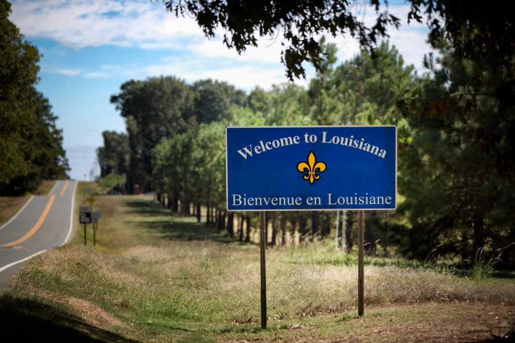
4 Enjoyable Nights in Breaux Bridge, Louisiana
In our North American travels, Linda and I have passed through Louisiana several times but have never stopped. Yet Louisiana’s history and culture are unique and inviting. As part of our February, 29 day RV road trip, we chose to make a four-night stop using Poche's...

How to Celebrate Canada Day During COVID-19 Restrictions
As safety measures continue in an effort to keep COVID-19 cases as low as possible, Canada Day parades, festivals, and other in-person events are off the table. Thankfully, event organizers have set their sights on new ways to celebrate to keep the fun...
Tide’s Out! Our Adventure at The World’s Highest Tides Ecozone
New Brunswick is rich in hands-on experiences with natural wonders and beauty along the shores of the Bay of Fundy. The Bay of Fundy tides is the highest on the planet at 53 feet vertical in the Minas Basin at the closed end of the bay. They are an unspoiled marine...

