The high desert of the American Southwest (which includes the Four Corners) is a very popular winter destination for Canadian RVing snowbirds. But for the 2020/21 fall and winter, with the boarders closed and the pandemic situation still unfolding, many travellers are finding their visits to the Four Corners region on hold.
At this point in time we don’t know when the border will open, but we are also choosing to err on the side of caution when it comes to health-related risks.
We are looking forward to making it happen when it is safe to do so – and we’re already talking about it and planning for fall and winter 2021/22!
There are moments when I worship our GPS, but overall I admit a predilection for paper maps. I like to see a wide view of the landscape we are driving through and to have it on something tangible; and nowhere is this truer than the Four Corners region of the Southwest. It’s an area so high on our travel list that we have a framed version of the map hanging in our living room.
The Four Corners is the only spot in the United States where four states borders intersect – Colorado, Utah, New Mexico and Arizona – in a timeless landscape filled with mountains, mesas, buttes, red rock, high desert and gaping canyons. It’s also home to the most traditional cultures in America: a sacred land to the Navajo, Hopi, Zuni and Ute people who honour the traditions of their ancestors.
This is widely known as Grand Canyon country … but that’s not all there is – not by a long stretch. The majority of visitors make a stop at Grand Canyon National Park, look at the emptiness on the map to the north and east, determine there is nothing there and then point their vehicle in the opposite direction. They drive away having missed starkly beautiful scenery in the very heart of the Southwest.
Roads criss-cross the Four Corners region, some of them blacktop, some dirt washboard, with some that are not RV-friendly (stopping to ask the advice of a local is a good idea, especially for some of the more remote routes). They lead to and from ancient ruins and communities, telling the stories of the Ancestral Puebloans, the Native Americans who lived in villages – pueblos – and from whom many of today’s Southwest tribes are descended. They each have stories to tell – of the ways these great cultures intersected, how migrations occurred, powerful communities disbanded, and new ones grew and flourished, continuing traditions laid down by their ancestors.
There is so much to see and do in the Four Corners that it takes books to list them all: hikes, museums, off-road tours into canyons, archaeological sights, Native American cultural stops, boating and visits to national and state parks. These are some of our favourite spots – most are in Arizona but some are beyond – although by no means an exhaustive list of what’s available.
LAND AND CULTURE ARE INSEPARABLE
The Colorado Plateau (the geological formation making up the Four Corners) is a windswept high desert – and this can mean cooler temperatures in the winter months, making spring and fall excellent times for an RV road trip. AAA publishes an invaluable, detailed road map called Indian Country, available at AAA offices in the Southwest and for sale at local shops. It shows every tiny crossroads community and every small roadway and is our go-to paper map for the entire Four Corners.
It’s also a remote region, so RVers should prepare with extra water and food, a working cell phone and clothes to suit the season. “Desert” does not mean always hot, although it does mean dry. Stores and gas stations can be few and far between. Camping options are a mix of national and state parks, private campgrounds and boondocking, often in spectacular settings where the air is scented with sage and pine.
Julian Smith, author of the MOON guidebook to the Four Corners describes the region as “all about deposition, uplift and erosion.” Layers of sediment accumulated, then lifted towards the sky by energies below ground and then finally moulded by the forces of wind, rain and ice. This was not a fast process: 300-million years of depositing, lifting and eroding formed the jaw-dropping mesas and canyons that punctuate the landscape.
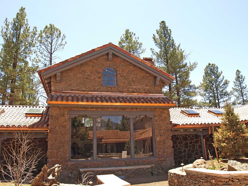
Flagstaff Museum
To understand and appreciate the Four Corners, an excellent starting point is the Museum of Northern Arizona on the outskirts of Flagstaff. Tucked into a stand of fragrant ponderosa pine, the museum is a place of cultural stewardship – it’s a primer to the Colorado Plateau and the geological and biological forces that shaped it as well as the more recent human cultural evolution. The displays at the museum are a snapshot of life on the Colorado Plateau – from the rugs woven by Navajo women and the carved Hopi katsina dolls to the way the biodiversity of the region is changing due to the forces of climate change.
The northeast quarter of Arizona – that area north of Interstate 40 and east of Grand Canyon National Park is filled with driving routes and stops for travellers who are not deterred by an out-of-the-way landscape. Flagstaff is a popular home base for visitors to the Grand Canyon and along with the motels and restaurants it has the full spectrum of services any RVer would need: laundromats, propane fill stations, grocery stores, campgrounds, potable water and dump stations.
SIGHTS ALONG THE WELL-TRAVELLED INTERSTATE
In addition to the excellent museum in Flagstaff, we stopped at the Lowell Observatory, home to The Pluto Discovery Telescope, a solar telescope to view the Sun and an open-air observing plaza with six advanced telescopes to gaze at the night sky. In 2001, Flagstaff was named as the world’s first Dark Sky Community, recognizing its safe lighting practices and moves to reduce light pollution.
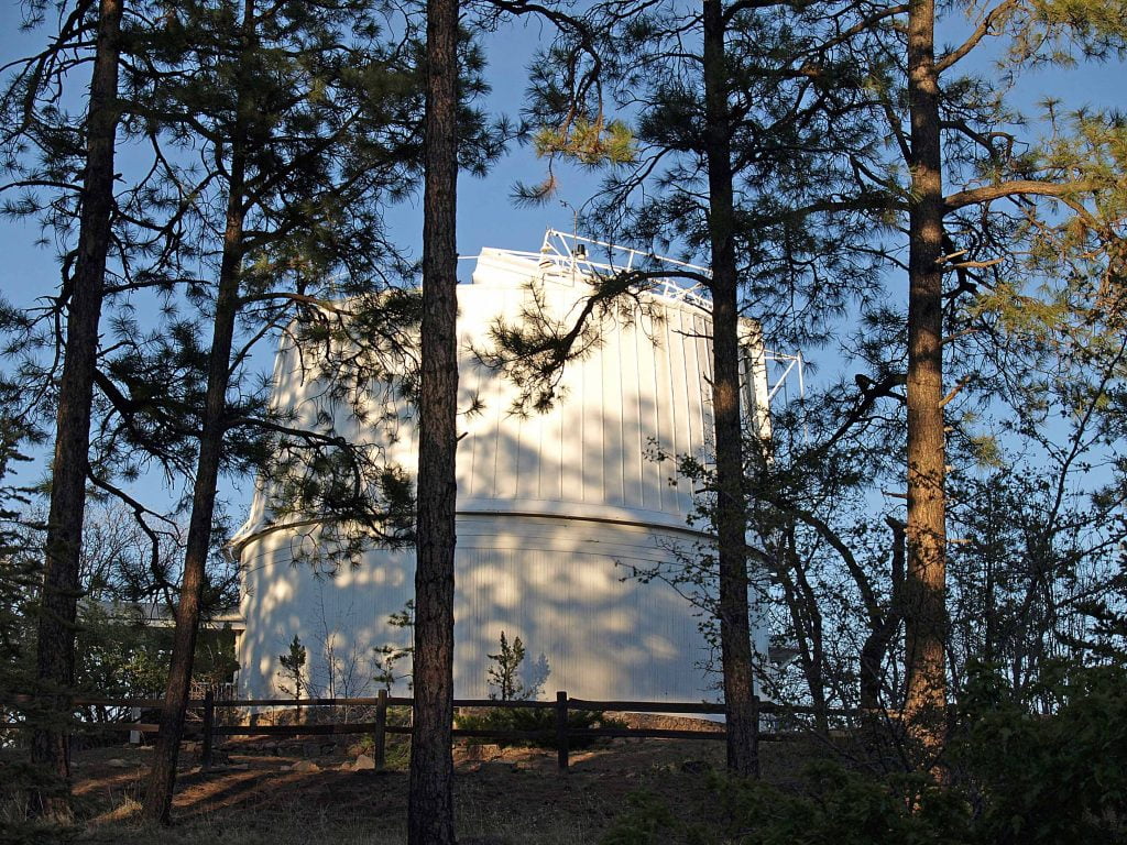
Observatory
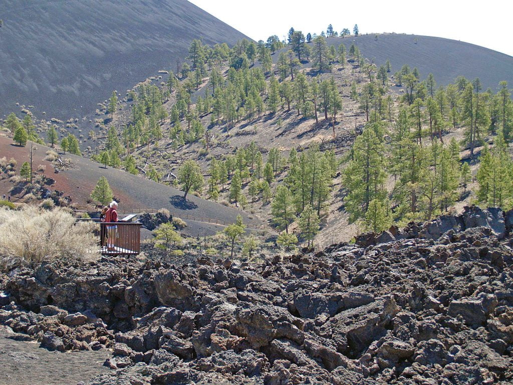
Sunset Crater
A short drive outside Flagstaff, the nearly symmetrical black lava cinder cone at Sunset Crater Volcano is what remains of an explosion and lava flow occurring almost a thousand years ago. At the time of the eruption, molten rock sprayed high into the air, solidified, and then plummeted to Earth as small cinders and large lava bombs. The easy Lava Flow Trail passes through hardened lava and cinder barrens to the base of Sunset Crater. The 800-year-old masonry pueblo remains at nearby Wupatki National Monument were once home to an ancient people who dry-farmed crops in the shadow of Sunset Crater. According to Native legend, the site’s blowhole in the rock surface where air rushes in and out is where the Earth breathes. There’s a self-guided trail, but tag along and eavesdrop if you see a park ranger leading a guided tour.
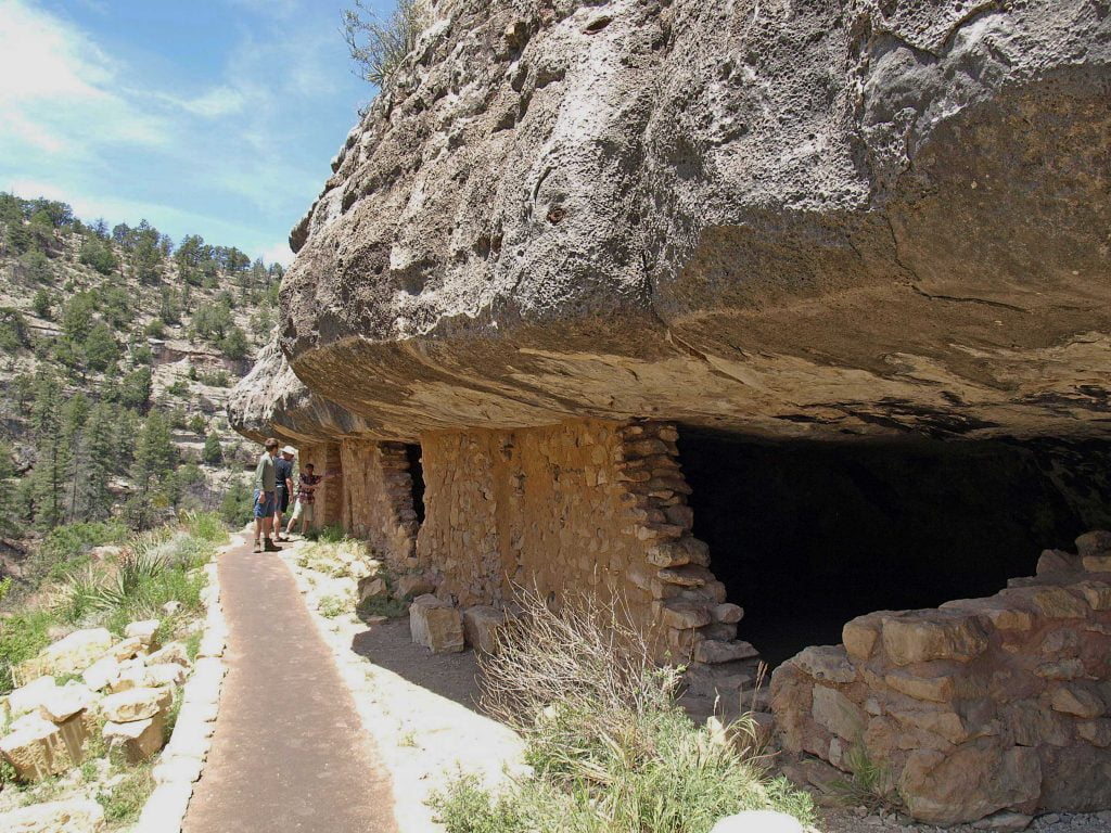
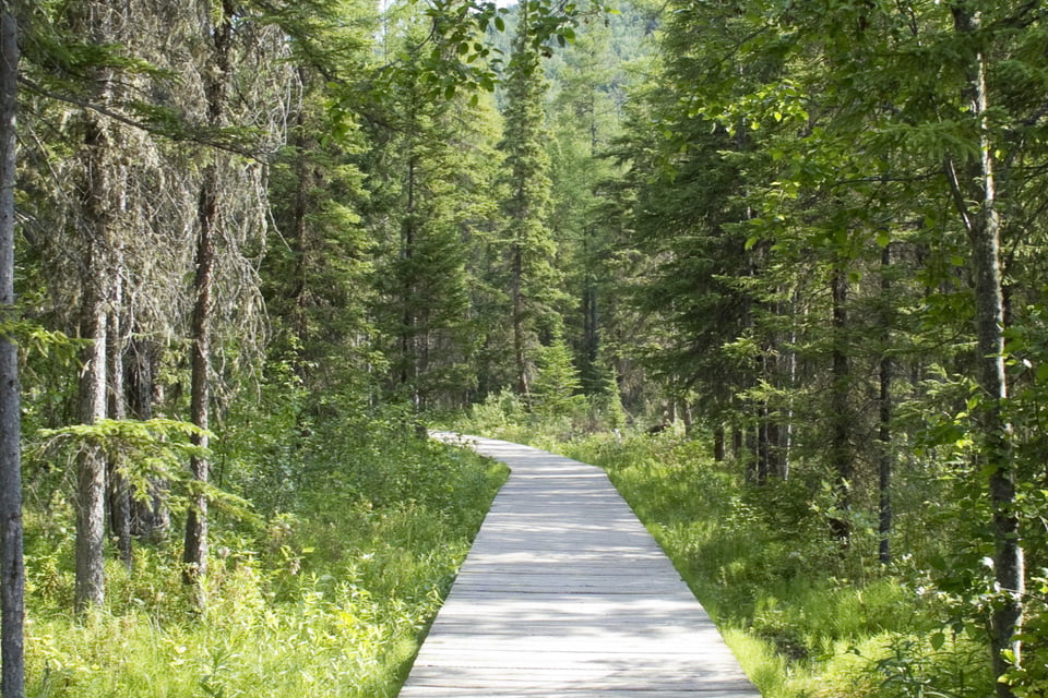
Walnut Canyon
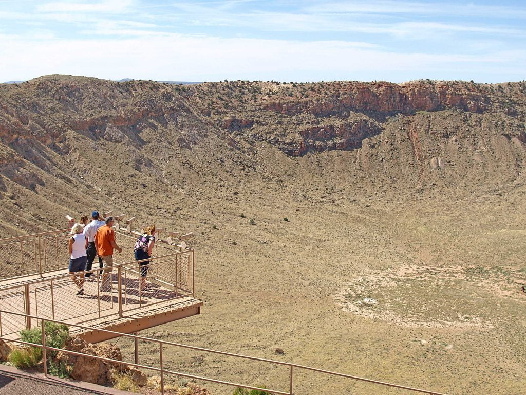
Meteor Crater
Not far off Interstate 40 east of Flagstaff, Sunset Crater Volcano’s well-preserved cliff dwellings were once home to the ancient Sinagua people (named to reflect the people’s ability to live “without water”). We huffed up the steep trail to the dozen preserved cliff dwellings with superb views over piñon, cacti and ponderosa pine-covered slopes. Nearby, about 50,000 years ago (a blink of an eye in geological terms) an asteroid collided with the Earth and the result is Meteor Crater, the first proven meteor crater in the world, and large enough to fit downtown San Francisco across its bottom. The stop at the picture-worthy crossroads in Winslow for a little 20th-century culture is irresistible (yes, it was immortalized by the Eagles: I’m a standing on a corner in Winslow, Arizona), complete with a red flatbed Ford. Petrified Forest National Park’s 45-kilometre main drive is a vista of geological wonders captured in the colourful crystal patterns of petrified wood scattered throughout this vast desert park. Legend has it that thieves who pilfer the pieces of petrified wood will be cursed with bad luck. The Visitor Center displays include letters from sorrowful visitors who are returning their cursed pieces of petrified wood.
TURNING NORTH TO EXPLORE THE HEART OF THE FOUR CORNERS
Winslow, Arizona is the point where we make sure our Roadtrek Class B is gassed up and we are fully stocked before we turn north to head into the heart of the Four Corners region. Often bypassed, the dozen Hopi villages – perched on First, Second and Third Mesas – get a fraction of those that flock to larger centres like Phoenix. The mesa villages are authentic destinations for travellers interested in Native American history, culture and archaeology.
Hopi
The Hopi are an Ancestral Puebloan people who trace their proud heritage to the great cultures that once inhabited the sprawling communities at Mesa Verde, Canyon de Chelly and Chaco Canyon. They have carefully guarded their beliefs and heritage and welcome visitors to their traditional, mesa-top villages and to the Hopi Cultural Center a place that introduces visitors to the deeply-spiritual ways of one of the continent’s oldest civilizations. Shops and small galleries along the Hopi Arts Trail are a way to connect with local artists who produce coiled baskets, brightly-painted katsina dolls, pottery and silver jewellery. These are small communities and it’s important to respect the culture, tradition and lifestyle of the people who live there. Ask before snapping photos; don’t trespass onto private property. Many sacred ceremonies are closed to the public, so it’s best to check first and to follow respectful decorum at all times.
Hubbell Trading Post
An hour east of Second Mesa, the Hubbell Trading Post in Ganado is a National Historic Site. The stone-walled, traditional trading post is the oldest continuously operating trading post in the Navajo Nation, open for more than a century. It’s also a good spot for the serious collector to purchase high quality Navajo rugs, Pueblo katsina dolls, pottery and paintings in a historic location. Even if you aren’t buying, it’s worth the stop to soak in the authentic setting, squeaky wooden floorboards and the long counters displaying the work of world-class artisans.
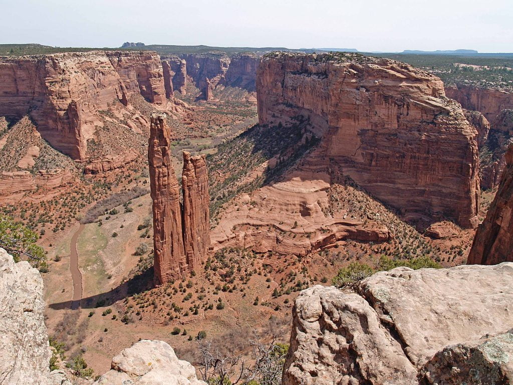
Canyon de Chelly
Just a short drive north of the trading post, the majestic Canyon de Chelly National
Monument – described as “the most sacred place on Earth” – is a labyrinth of precipitous sandstone gorges, towering rock spires, small forests of Russian olive and pine trees, ancient ruins and fertile farmlands still being worked by Navajo families. Scenic drives and hiking trails line the north and south rims and there is one short public trail to the White House ruin, an Ancient Puebloan village on the canyon floor dating to A.D. 1060. There are few sites in the Southwest as breathtaking as Canyon de Chelly’s Spider Rock, a towering 230-million-year-old red sandstone obelisk rising 229 metres, that legend tells is home to Spider Woman, the holy woman who taught the Navajo how to weave.
There are free ranger-led hikes into the canyon but for a deeper and more detailed exploration of this very special site, we took a jeep tour with an authorized Navajo guide. The park’s Cottonwood Campground has 90 campsites available, each with a picnic table and grill, that can accommodate RVs up to 40-feet in length (including tow vehicles). There are restrooms and a dump station but no showers or hook-ups.
THE FOUR CORNERS BEYOND ARIZONA
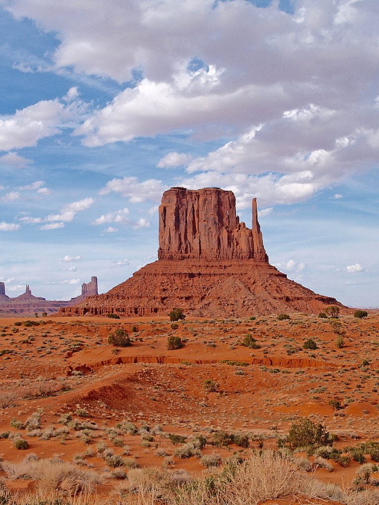
Monument Valley
Crossing the northern border of Arizona into Utah brings a jolt of recognition. The spellbinding Monument Valley Navajo Tribal Park has been the backdrop for countless movies and television commercials. It’s a dreamlike vista of red sandstone formations, fragile pinnacles, buttes and mesas where land and culture are tightly woven together. Legend says the sandstone spires of Monument Valley mark the bodies of slain monsters. The rutted loop drive is not RV-friendly but Navajo guides show off the best of the mesmerizing landscape on jeep tours into the backcountry. We had beautiful overlooks from our campground at The View; although there are no hook-ups, full restroom and shower facilities are available to all campers. The historic Goulding’s Trading Post near the entrance to the park has an RV campground with site views over Monument Valley. RV sites have full hook-ups, picnic tables, grills, with access to bathrooms and showers, indoor pool and Wi-Fi.
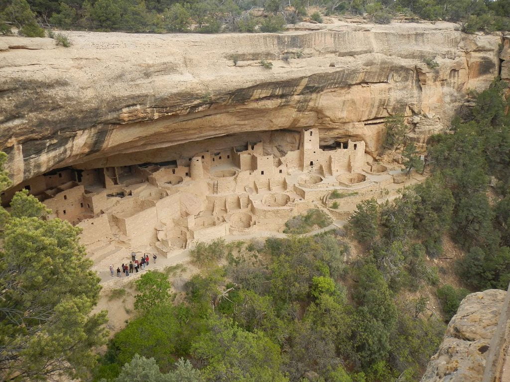
Mesa Verda
It’s an easy half-day drive from Monument Valley east through a land of red and orange rocks to the base of Mesa Verde National Park, the only park in the national system based on human activity rather than natural features alone. The park protects the remains of thousands of cliff dwellings, pithouses, kivas (traditional ceremonial rooms) and stone structures, all built 2,600 metres atop the flat-topped mesa in southwest Colorado. It’s a steep, twisty drive to the sights and the campground at the top of the mesa, so best done only by those comfortable with challenging road conditions. At this elevation there is about 20 per cent less oxygen than at sea level. We slowed down, stopped often to rest on walks and hikes. We camped several nights at the park’s Morefield Campground; there are 267 sites but just 15 full hook-up RV sites (reservations required). The campground has an RV dump station, laundry, showers and nearby gas station and grocery store.
At one time, thousands of people lived in the Mesa Verde dwellings – embedded in a brutally challenging environment on the sides of the cliffs. Somehow, between gathering food, water, tending animals and children, they hand-built brick and mud dwellings in the rock face, filled them with articles of clothing and thousands of handcrafted baskets and clay pots. They domesticated dogs and turkeys – whose feathers they used for clothing – and did everything, including transporting water, by hand. They achieved this all without beasts of burden, the horse or the wheel. Then mysteriously they suddenly moved, but did not disappear; their descendants live along the Rio Grande and on the Hopi lands in Arizona.
Why did they migrate to where the geography is harsh and unforgiving, dry and exposed to the elements, teetering on the cliff face, hard to get into and hard to get out of? Why did they suddenly leave generations later after putting so much ingenuity and labour into these elaborate homes and ceremonial kivas? Mesa Verde protects this history and explores the answers to these questions.
The park has kilometres of hiking trails, but stops into Balcony House, Cliff Palace and Long House cliff dwellings can only be visited by taking a ranger-guided tour. There’s a full menu of guided tours – we opted for the ranger-led 151-room Cliff Palace tour as well as the half-day 700 Years Tour, where guides use the architecture of pithouses, kivas and masonry walls to illustrate the changes along a timeline from 600 to 1300 A.D.
The imposing Cliff Palace is one of the park’s 600 cliff dwellings and at 151 rooms is the largest excavated cliff dwelling in the northwest hemisphere. The Ancestral Puebloan people who lived and worked and raised families under these rock overhangs were there for 750 years, three times as long as the United States has been a country.
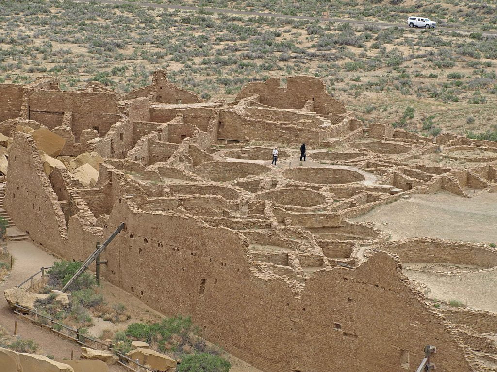
Chaco
It’s a short drive from Mesa Verde into northwest New Mexico and one of our favourite sites in North America, Chaco Culture National Historical Park. The elaborate ruins at Chaco’s high desert were once the ceremonial, trade and cultural centre of a great Ancestral Puebloan civilization, creating an even deeper significance for the Southwest Native peoples of today.
It’s a bumpy washboard road in from Highway 57 along 30-km of rough dirt road, cattle guards and lots of ruts. The road is not recommended for larger or low-clearance RVs but if you can make the trip into the park the Gallo Campground it is well worth the effort. The rugged, desert campground has no shade, but sites are outfitted with a picnic table and fire grate (no firewood is available in the park). The campground has water and restrooms but no showers or hook-ups. There is no gasoline, auto repair, food or ice available in the park, so arrive prepared.
Chaco stands alone compared to most other parks, and because of its remote location the UNESCO World Heritage Site receives few visitors. Archaeologists and Archaeoastronomers pinpoint Chaco as the high-water mark in the thriving Puebloan cultures of millennia past. Spread out across the canyon’s wild beauty of rock, piñon and creosote, the excavated ruins are dominated by monumental architecture built with an estimated 50-million slabs of sandstone. Multi-storey buildings with hundreds of rooms called Great Houses were oriented to solar, lunar and cardinal directions. How the Chacoan people managed such sophisticated calculations is one of the site’s great mysteries.
Astronomy clearly played a major role in Chacoan culture. The residents organized their lives around the harvest of corn, squash and beans, being attuned to seasonal patterns by following the progress of the sun, tracking the path of its shadow as it cut across stones erected as astronomical markers. So precise was this ancient calendar that they aligned the massive walls of one Great House, Pueblo Bonito, along the axis of the summer-winter equinox, and then oriented distant buildings and roads to the same coordinates. It is an impressive feat of engineering.
Certified as a Dark Sky Park, the site offers The Chaco Night Sky Program through its permanent observatory. Even without the aid of telescopes, the nighttime sky is an inky black template spotted with millions of pinpricks of light that dot right down to the horizon.
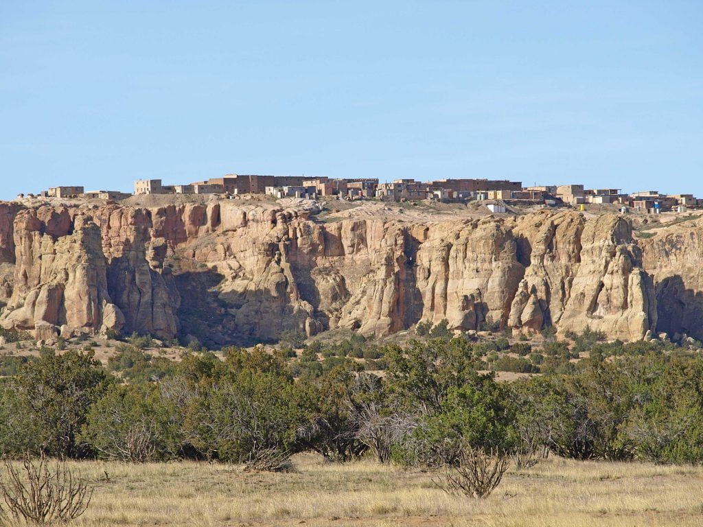
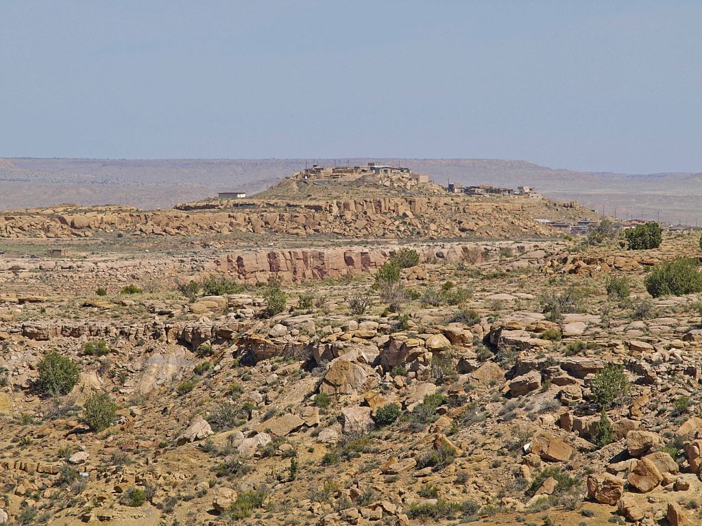
Acoma
Leaving Chaco is always a sad moment in our RV travels, but this time we were headed just three hours south to Acoma Pueblo, a New Mexican pueblo village also known as Sky City. Acoma is perched on top of a windswept, barren sandstone butte – sometimes described as a 70-acre island thrust 30 storeys above the desert floor – with a solitary cottonwood tree giving precious shade.
Acoma is one of the oldest continuously inhabited communities in North America. Until the late 1950s, the only way up to Acoma was to climb a rough foot-hole trail zigzagging back and forth through slices in the steep rock walls. The Spanish conquistadors immediately declared the settlement on the bluff as being “a rock with a village on top, the strongest position in all the land.” That didn’t deter them from storming Acoma and inflicting years of injustice, slavery and brutality on the people of Sky City. The decades of conflict, followed by eventual capitulation, introduced Hispanic influences and the Catholic religion into the lives of the Acoma tribe.
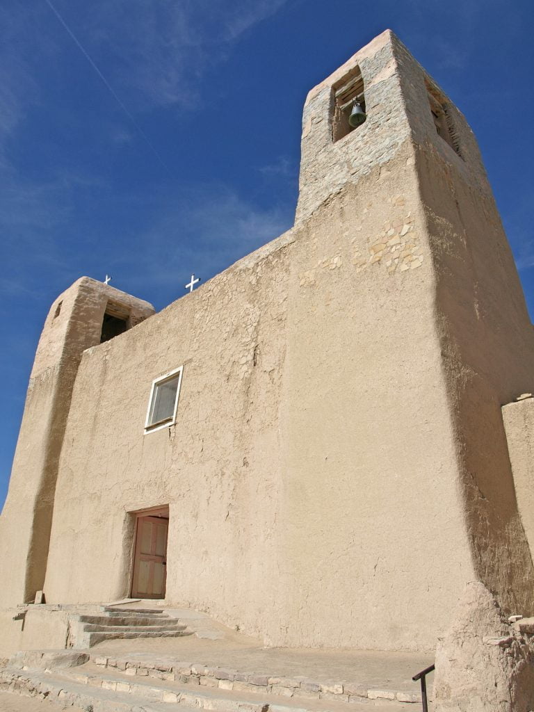
Acoma
Before a road was built to the top, generations of the Acoma people demonstrated their resiliency to survive – hauling tons or earth and rock up the narrow pathway to build the 300 village buildings made of adobe brick and white sandstone blocks, including the San Estevan del Rey Mission. Simple in design and décor, this National Historic Landmark is one of the largest Spanish missions in New Mexico. Built on sacred ground to the spiritual Acoma, the massive church has three-metre thick walls and a wooden ceiling of exposed beams built from timbers carried overland from sacred Mount Taylor, without allowing the men to rest the heavy timbers on the ground at any time in the 13-km trek.
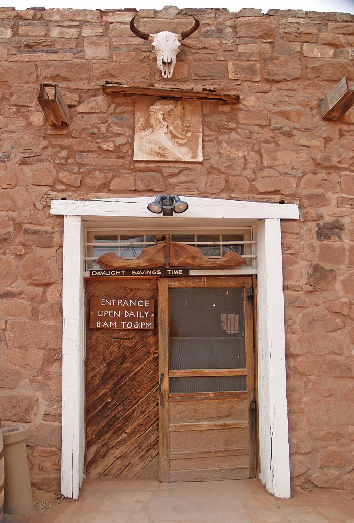
Today, of the six-thousand members of the Acoma tribe, only a few families live on top the mesa full time; although most of the tribe members still own homes in the two and three-storey adobe buildings that line the uneven, dirt pathways of Sky City. A one-hour walking tour of the pueblo is conducted by native Acoma guides and is the only way visitors are allowed on top of the mesa.
At the base of the mesa, the living history of this tribe is told in the Sky City Cultural Center, with one thousand years of Acoma history, artifacts, ancestral remains and teachings on display.
The nearby Sky City RV Park has 42 big rig-friendly RV sites with full hook-ups, dump station, laundry and Wi-Fi.
There are few places in North America with the spiritual nature of the Four Corners region. In these very special stops, both the land and the people have flourished through the arc of time – making it the perfect destination for an RV vacation.
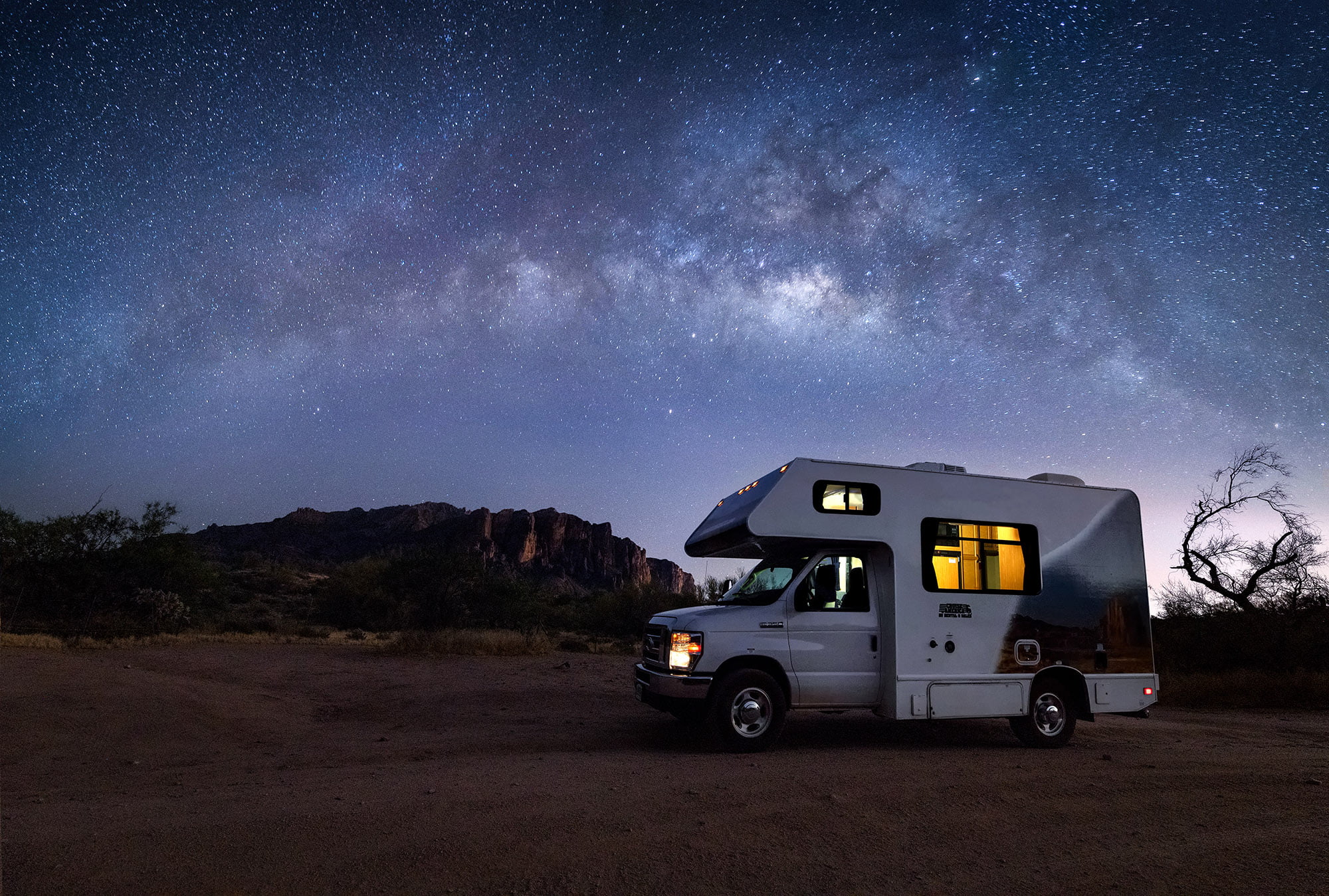
Feature image courtesy of John Weatherby
Related Articles
Quick Visits and Quicker Meals
Among the many wonderful aspects of RVing are our choices regarding where we park our units. Whether we define ourselves as fulltimers, weekenders or somewhere in-between, staying at a seasonal site provides us with a base camp and a launching-off point. Some RVers...
The Magic of Boldt Castle – An Anniversary to Remember
It was under a clear blue sky, on that warm September afternoon, that the twin diesel engines of the cruise ship, Thousand Islander II, gave a final thrust as the captain placed the boat gently against the floating dock at Heart Island, New York State. Our tour of...
Liard River Hot Springs Provincial Park
Whenever we travelled the Alaska Highway, up or down, the Liard River Hot Springs was a must stop. Sometimes it was just for an hour or two for a quick soak. Other times we stayed for a night or two. (We lived in the Yukon from 1982 to 1998.) The Liard River Hot...

