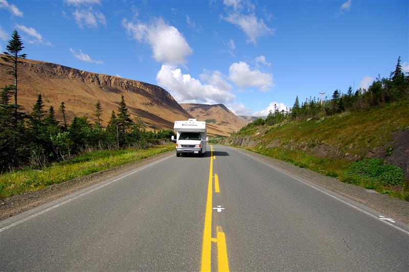
Travelling through Newfoundland in a well-equipped RV, “moose” should be the first word on your radar. Accidents happen daily. The giant mammals rule the roadways, and guidebooks warn that the only safe way to drive in moose country is below the speed limit and keeping an eye on the shoulders of the road.
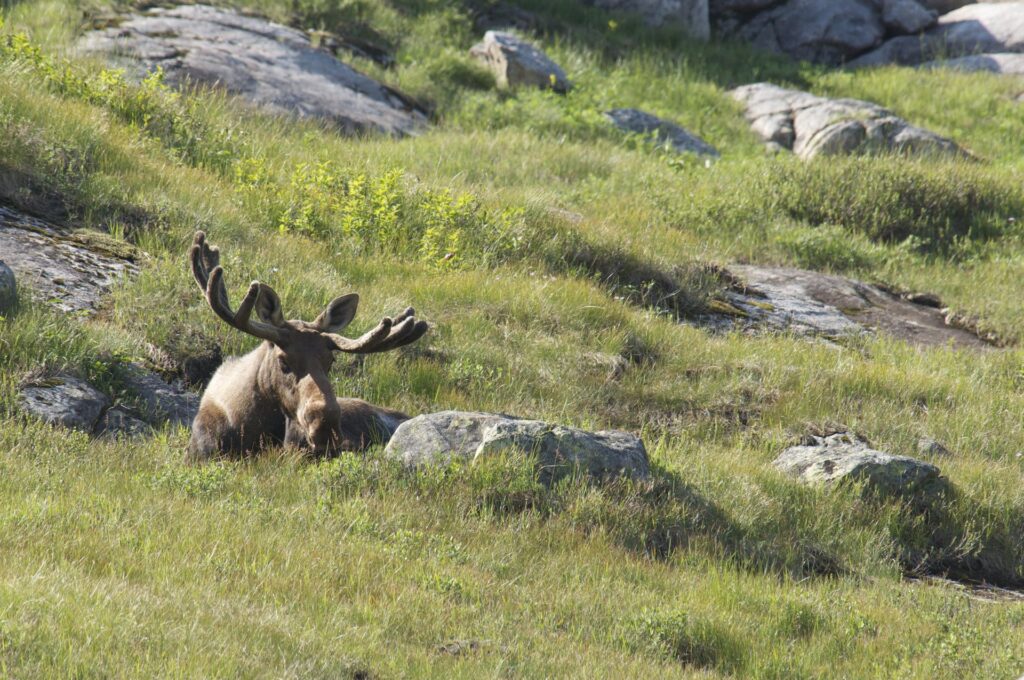
Bull Moose, Gros Morne National Park Credit: Newfoundland and Labrador Tourism
The western arm of Newfoundland—a much-desired 700-kilometre route for RVers—is prime moose country (Gros Morne has one of the province’s highest densities of moose). To hear the locals tell it, there should be a moose behind every tree and around every bend on the trail. The North American Moose is not native to the island; it was first introduced around a century ago, just two cows and two bulls brought in from Maine, most probably as food animals. What started as four moose has grown to an estimated 125,000 (one for every four residents). Moose are a very important source of meat—for the average Newfoundlander, hunting for moose is grocery shopping. Freezers are full; moose burgers are a staple on restaurant menus. For visitors and campers, just sighting a moose is high on the holiday checklist.
Getting to Newfoundland in an RV is no simple task. Canada’s most easterly province is linked by three different ferry routes (two to the south coast and a short ferry connecting the island to Quebec). Although Newfoundland lends itself to many parks and boondocking sites (check the iOverlander), it’s a wise plan to book the first night after arriving at J.T. Cheeseman Provincial Park, just 10 kilometres from the Port aux Basques ferry docks.
HUGGING THE WEST COAST OF NEWFOUNDLAND
The highway snaking along the coast of western Newfoundland traces a magical route with the Gulf of St. Lawrence to the west and a mixture of bogs and mountains to the east. Many travellers arrive on the island in the southwest at Port aux Basques and work their way to Corner Brook and Deer Lake and then meander to the northern tip along Highway 430, nicknamed the Viking Trail. North of Deer Lake, look for Sir Richard Squires Memorial Provincial Park (148 campsites, many can accommodate larger RVs), where you can see the salmon jumping at the waterfalls.
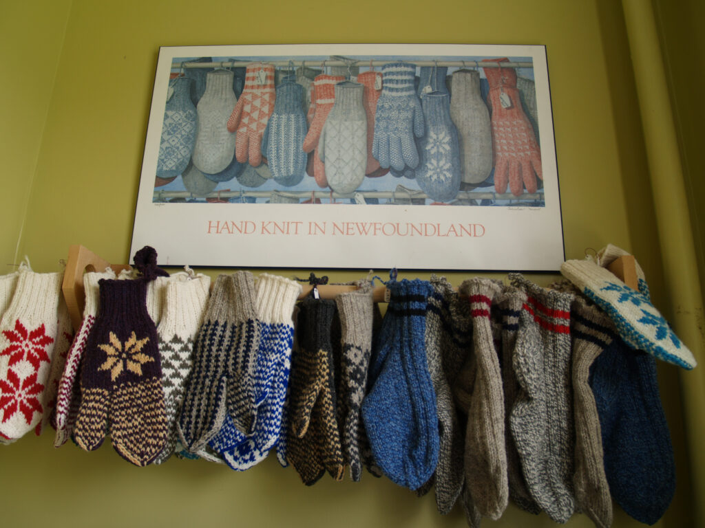
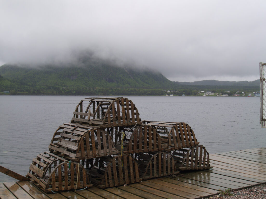
The coastline is peppered with traditional fishing villages that sometimes seem to merge into one another. At Lark Harbour (northwest of Corner Brook), whales and icebergs can be sighted in the bay, and local artisan shops sell hand-knit crafts. Lobster traps are stacked along the waterfront. Woody Point is renowned for its artsy feel, colourful clapboard houses, and annual writers’ festival. Newfoundlanders are famous for their hospitality and are always willing to give directions and advice.
The Viking Trail was the route that grabbed our attention—heading for the famous Gros Morne National Park and then further north to the historic Norse settlement in the small cove of L’Anse aux Meadows. Along the way are endless ocean views, peninsulas to explore, historic sites, lighthouses, and a nonstop number of small communities.
To mainlanders, Newfoundlanders speak with a quirky sense of direction. As a local explained to us, “One thing you need to understand here is that north is down; so, driving north along the coastline, you are actually driving down the coast.” This makes perfect sense to residents, whose seafaring instincts lead them to describe direction in terms of the prevailing winds. With the predominantly southwest summer breeze, you sail downwind in order to head north. Trust your map and GPS but keep this in mind when conversing with the locals.
With the Viking Trail along the coast, you’ve got the salty sea on your left-hand side and bogs stretching to the Long-Range Mountains on your right. The bogs are sphagnum moss-dominated wetlands that have been growing for millennia, punctuated by many shallow ponds. Under the spongy moss is a series of limestone ridges that stretches along in a pattern of ripples and hollows. The moss fills in the dips, spreading outward and blanketing more ground with each year’s growth.
In Newfoundland vernacular, this type of landscape is a “mish.” Most of Newfoundland’s terrain is bogs and ponds. The mish is prime territory for herds of woodland caribou who choose to winter on the lowland bogs, pawing through the snow to feed on the tender moss. In the summertime, look for them near the coastal community of Port aux Choix.
Western Brook Pond Gorge, Gros Morne National Park. Credit: © Newfoundland and Labrador Tourism / Barrett & MacKay Photo
GROS MORNE NATIONAL PARK
Gros Morne National Park—one of Canada’s 22 UNESCO World Heritage Sites—is Canada’s largest eastern national park, known for its mountains, landlocked lakes, and dramatic glacial valleys, intertwined with the human history of coastal communities. The Long-Range Mountains are the northernmost section of the Appalachians, a 300-million-year-old mountain chain where alpine dwarf tundra vegetation and fauna can be found due to its elevation.
It’s a wild place where rock from the Earth’s mantle was pushed hundreds of kilometres to the surface during the jigsaw collision of plate tectonics some 450 million years ago, creating mountains, inland fjord lakes, glacial valleys, and coastal seascapes. The park is a main destination for visitors to the island, drawn by spectacular scenery and complex geology intertwined with human history. It’s one of the few spots on the globe where you can walk a hiking trail on the mantle of the Earth.
Tablelands, Gros Morne National Park, UNESCO World Heritage Site. Credit: Newfoundland and Labrador Tourism © Dru Kennedy
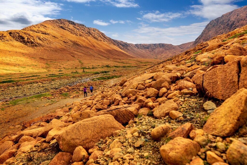
A highlight in Gros Morne is the Tablelands, the barren, ochre-coloured peridotite rock that once sat 10 kilometres below the ocean floor. Peridotite is the rock of the Earth’s mantle, and the golden Tablelands plateau is one of the few spots on the planet where it has bulged to the surface. It’s a textbook of glacial and post-glacial features and a dream come true for geologists studying plate tectonics.
At the surface of the Earth, this mantle rock is unstable; it weathers quickly and crumbles into a soil so sterile that few plants can take root and live. With so little vegetation, the Tablelands may look desert-like, but there’s always water trickling through streams and into small pockets of well-developed wetlands, tucked into the surrounding rock barrens.
As a park guide told us, “These strange rocks were a mystery up until the 1960s, and the study of them played a major role in confirming the theory of plate tectonics. These rocks are not adapted to being at the surface—they are normally below the base of the oceans.” It’s an incredible place to stop and explore.
Gros Morne National Park has 236 sites (44 with full hookups) spread over five campgrounds, most with flush toilets, hot showers, dump stations, and access to Wi-Fi.
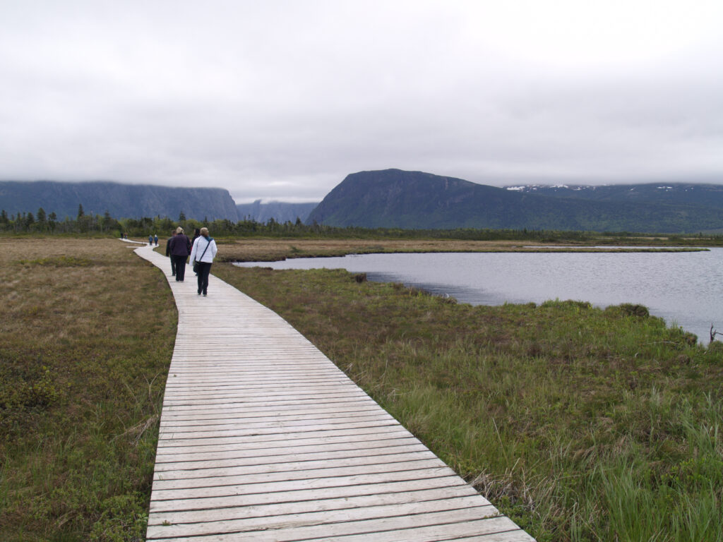
A boardwalk trail leads across the bog to the boat launch at Western Brook Pond
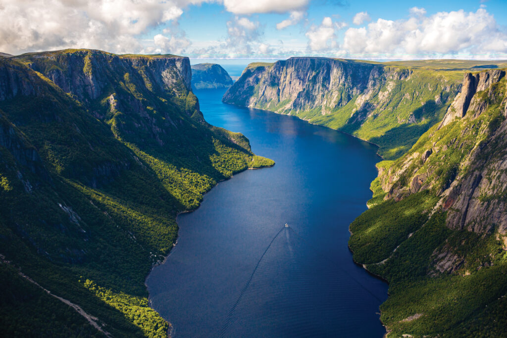
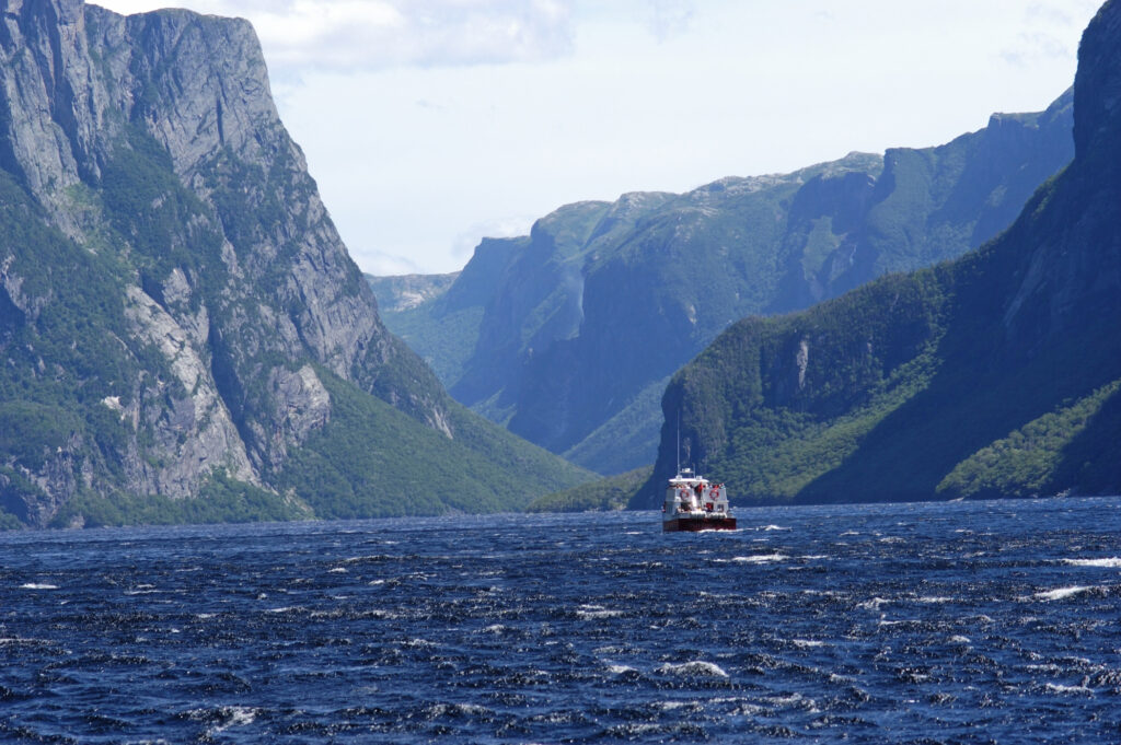
WESTERN BROOK POND
Inside the boundaries of Gros Morne, the craggy walls of Western Brook Pond and the metres-thick peat bogs that border it tell of changing sea levels and powerful earth movements. Carved by glaciers, the landlocked fjord was once saltwater, but, closed off from the ocean, it now contains freshwater.
Boat on Western Brook Pond, Gros Morne National Park. Credit: © Newfoundland and Labrador Tourism
Boat tours cruise into the narrow fjord, past billion-year-old cliffs and waterfalls spraying a fine mist into the air. Whether you take the two-hour cruise or not, the half-hour hike to the dock past lowland coastal bogs is worth the effort.
On land, there are 20 trails in the park, ranging from a half-hour to five days. The site’s iconic cliffs are the uplifted roots of the Appalachian Mountain chain and part of the Canadian Shield.
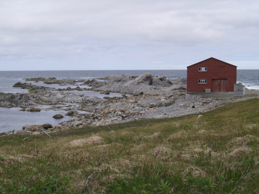
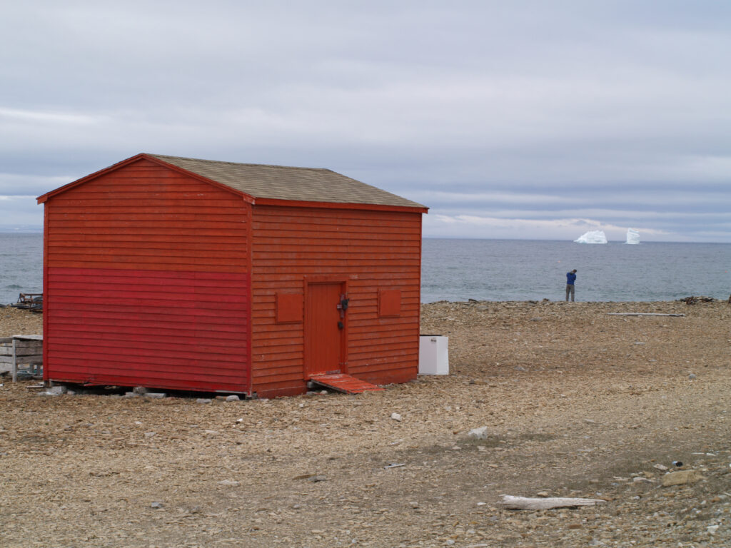
The little red building at Broom Point was used for decades as a saltfish storage building.
BROOM POINT FISHING EXHIBIT
Also, a part of Gros Morne, along the rugged west coast, the small fishing community at Broom Point was once a hive of activity: in days gone by, hauling in the cod catch, cleaning, salting, and spreading the fish on the rocks to dry. Children worked in the family business from the age they could lift and flip a codfish.
Now a Parks Canada interpretive program, the cabin and fish store capture life stories of the families who relied on the lobster, cod, and salmon fisheries; a snapshot in time of a seasonal fishing community dating back generations. The outbuildings, which stored boats and nets, were made by hand from cotton twine. The small wood-heated cabin was once home to the Mudge family—the 10 family members worked together salting and drying.
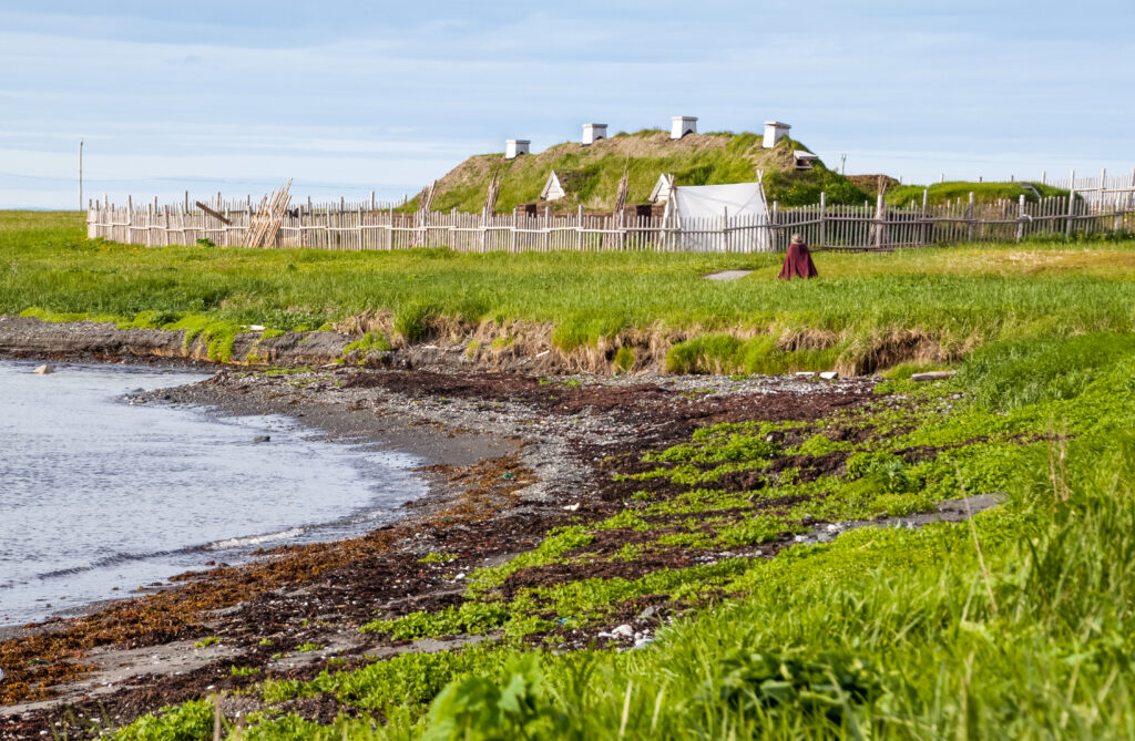
View of Norse Sod Huts, L’Anse aux Meadows National Historic Site. Credit: © Parks Canada / Sheldon Stone
L’ANSE AUX MEADOWS NATIONAL HISTORIC SITE
At the windswept northern tip of Newfoundland, the remains of turf-walled houses and strange earthen mounds at L’Anse aux Meadows mark the earliest known evidence of European settlement in the New World. Archaeologists discovered bronze pins and nails made from bog iron—it’s believed the Viking Leif Ericson settled there more than 1,000 years ago. On a cold, windy day, you can’t help but be overwhelmed by this footprint in time.
Declared a UNESCO World Heritage Site, L’Anse aux Meadows is North America’s only authenticated Norse site. It’s a time warp to where the Vikings once stood when they landed. Interpretive guides in period costume bring history to life as they share the heroic and tragic tales of Thor, Loki, Eric the Red, and more. Visitors can try their hand at blacksmithing or weaving, learning how to throw an axe, take a pottery lesson, or wander around a replica Viking ship.
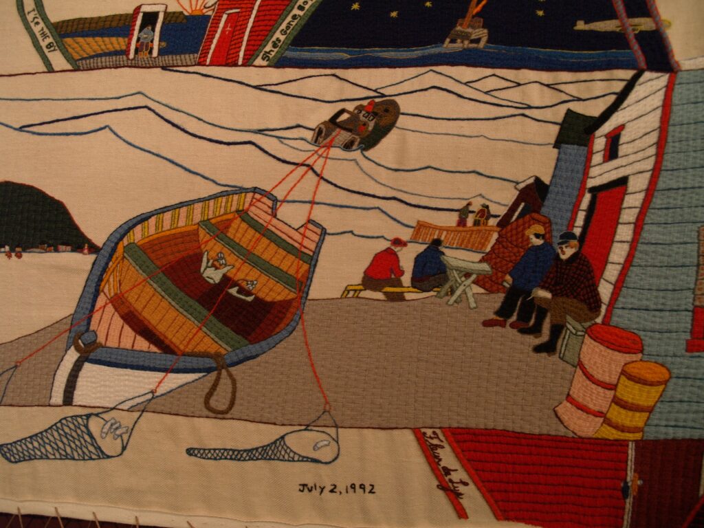
The French Shore Tapestry was created by a group of women in the small village of Conche to tell the story of the French Shore fisheries.
FRENCH SHORE TAPESTRY
A two-hour drive south of L’Anse aux Meadows is a small wooden outbuilding that once stored saltfish in the tiny fishing village of Conche. It’s in this space that the women of Conche came together to create a tapestry—one stitch at a time—creating a historical diary of their stretch of coast known as the French Shore. It’s known as the French Shore Tapestry and is now housed in the community’s French Shore Interpretation Centre.
Inspired by the 1,000-year-old Bayeux tapestry in France, the 66-metre Conche tapestry took 13 women of the outport four years to bring to fruition. Along the way, they were helped and guided by a French artist who arrived on The Rock with a goal of painting the communities he saw.
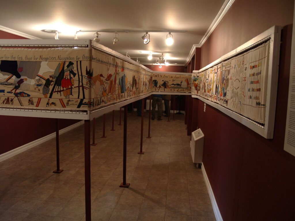
The colour-splashed length of linen twill dominates the museum’s showroom, following the history of Newfoundland from the fisheries to moonshine to entry into Canada in 1949.
While the women were creating the tapestry, they were also working days in the fish plant. In the evenings, they came together for thousands of hours of stitching and conversation. The beautiful tapestry draws visitors to Conche.
The French Shore Interpretation Centre tells the stories of the French cod fishery on the northeast coast of the Great Northern Peninsula and of the communities of Conche, Croque, and Grandbois/St. Julien’s. In addition to the beautiful tapestry, exhibitions trace the history of the earliest recorded voyages in the early 1500s, exploring the lives of the French fishers and their families.
No matter which community, park, peninsula, or shoreline you visit in Western Newfoundland, you’ll be met by friendly people, beautiful scenery, and a proud history on Canada’s easternmost province. It’s a trip custom made for RV enjoyment.
TRAVEL INFORMATION
gowesternnewfoundland.com
www.newfoundlandlabrador.com
Try some quirky Newfoundland food (moose burgers and scruncheons, that island delicacy of fried cubes of fat-back pork).
Don’t miss the moose-off-the-hoof at the restaurant at the Fisherman’s Landing Restaurant in Rocky Harbour. Order the Moose Burger Platter.
The Lightkeeper’s Café in St. Anthony serves bowls of seafood chowder, thick with clams, shrimp, and scallops.
Related Articles
RVing on Vancouver Island: Must-Visit Destinations
As full-time RVers who spend our summers on Vancouver Island in British Columbia, my wife Sandy and I have had numerous opportunities to explore various communities on both coasts of the island. Occasionally, fellow RVers will ask us about our favourite...

Canada’s Storybook Sites: Where Kids Meet Canadian History
History. Before your eyes glaze over, consider that Canada is chock-full of fun ways to explore and engage kids in the past of this amazing country. And does history matter? Sure does. Consider this famous quote: “A generation which ignores history has no past and...
How a Pandemic Turned Us Into First-Time RVers
There is no parenting book called “What to do with your kids during a pandemic”. When COVID-19 took away the everyday life that we always knew, and had everyone staying home, my husband and I found ourselves both working from home with three kids and a wild Jack...

