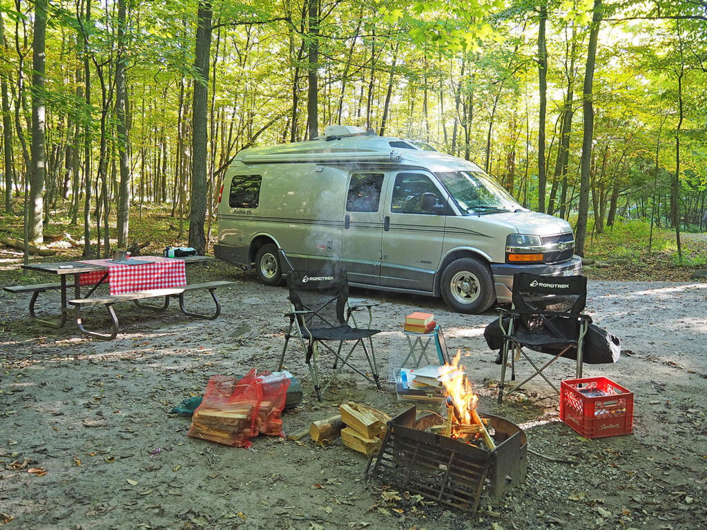
As the pandemic stretches on, it’s as important as ever to look close to home for travel opportunities. Travelling by RV — we describe it to friends as our “rolling self-isolation unit” — does give us more control, but it is still important to minimize risks. Enjoying the outdoors and not venturing too far are ways we can do that and still scratch that travel itch.
Count us lucky to have the world-class Rideau Canal right in our eastern Ontario backyard. The historic 202-km waterway is a Canadian Heritage River — Ontario’s first UNESCO World Heritage site. For decades the canal has been drawing recreational boating traffic, from canoes to decked-out houseboats.
Most people think of exploring the Rideau by water, but it’s also a fun driving route that can be taken in small bits or spread over several days. Along the way are private campgrounds, beautiful provincial parks, boondocking sites and some wonderful Harvest Hosts spots. And — should the pandemic restrictions allow — Kingston, Westport, Merrickville and Ottawa have more than enough activities to round out several days of a road trip.
A LITTLE HISTORY
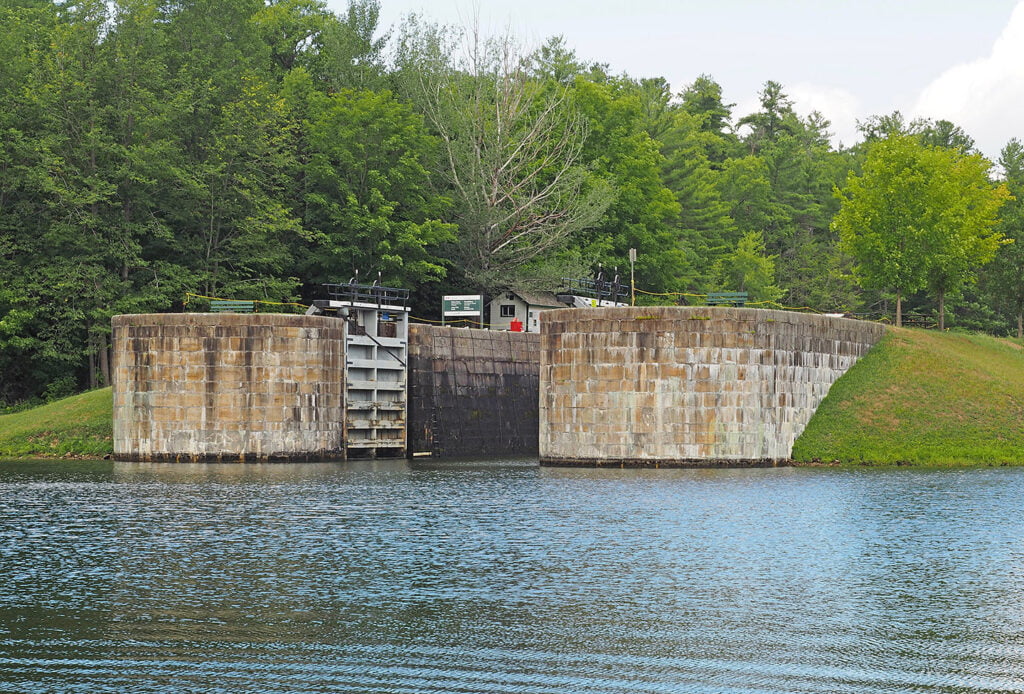
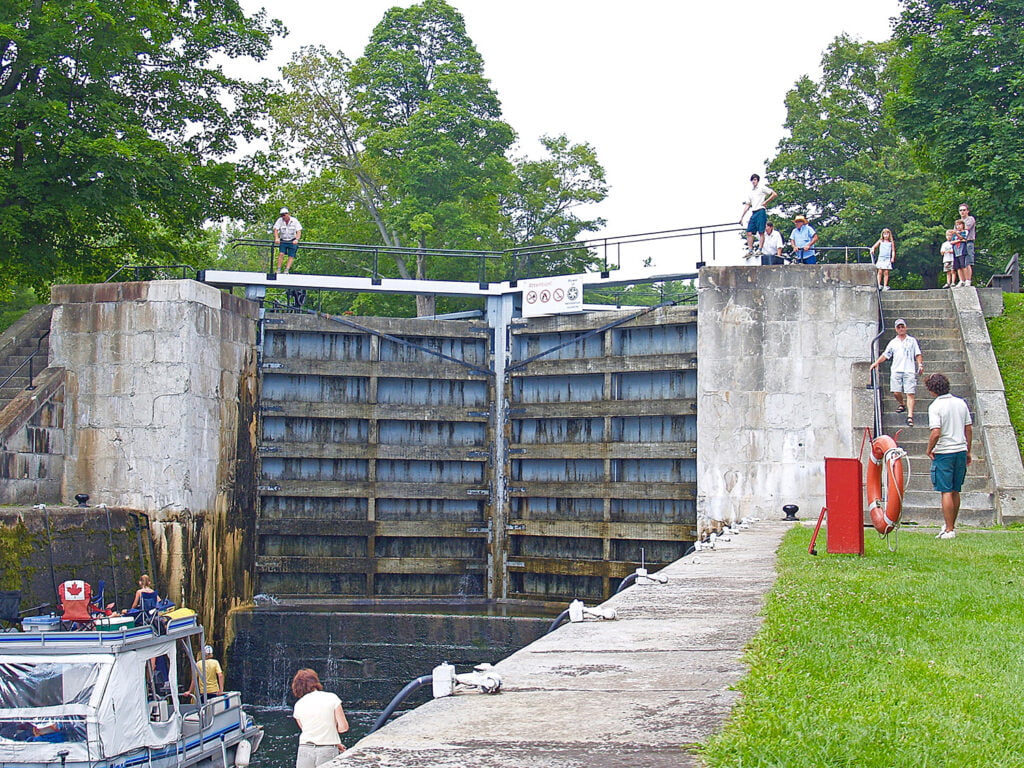
The Rideau Canal is the watery link connecting villages and towns between Kingston and Ottawa. Through a system of 47 locks at 24 lockstations, the canal allows water vessels to rise and descend through challenging terrain from the Ottawa River to Lake Ontario at Kingston.
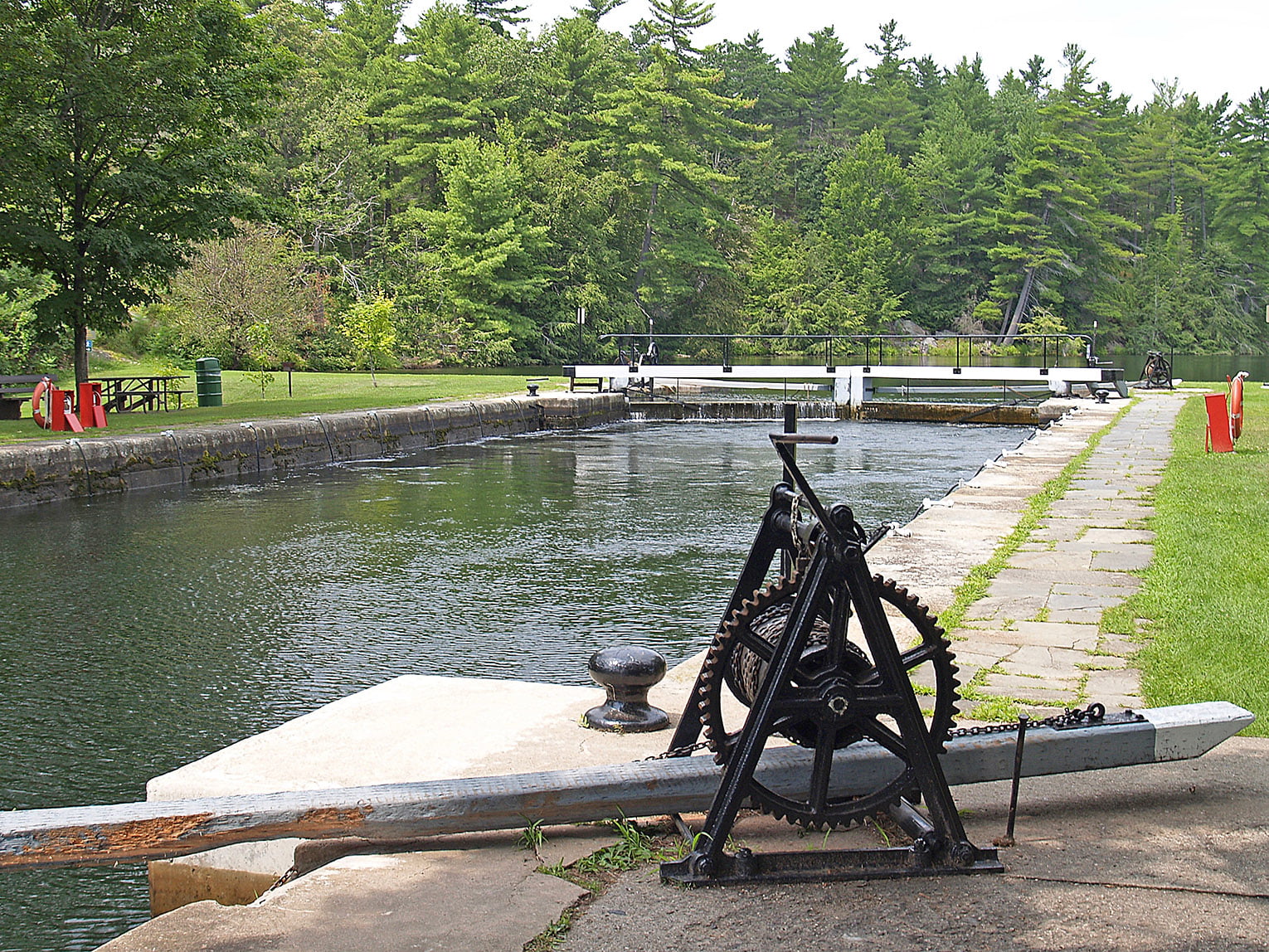
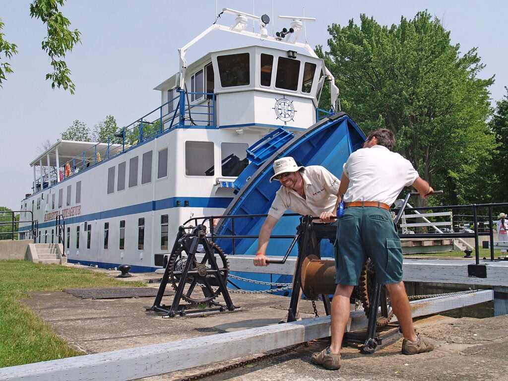
Locks are engineering marvels, used to move watercraft between stretches of water of different levels. The gated chamber of a lock works like a set of balancing scales, raising or lowering water levels to allow boats to navigate around obstacles like waterfalls or rapids. At most of the Rideau locks, the Parks Canada staff still use the original hand cranks to open and close the doors of the massive water chambers.
After the War of 1812 it was clear the St. Lawrence River — Britain’s only supply route between Montreal and the Great Lakes — was exposed to attack by the United States. Lieutenant Colonel By — designer of what is now the oldest continuously operated canal system in North America — imported technology from the Old World to build a secure wartime Upper Canada route to shuttle troops and supplies out of reach of American forces. In the end, it was never used for soldierly purposes and by the late 1800s had lost its military significance, even yielding its commercial use to the expanding railway. Pleasure boating followed, and the canal boomed as a recreational waterway.
The stonemasons who built the navigable channel through the rugged Canadian Shield of eastern Ontario stayed and built the historic villages that grew and flourished at the lock stations. Blockhouses and heritage stone buildings have been transformed into Parks Canada museums, telling the history of British North America and the building of the canal.
SOUTH RIDEAU: BEGINNING IN KINGSTON AT LAKE ONTARIO
The Limestone City (as Kingston is nicknamed) is known for its walkable heritage downtown, waterfront and marina, lively festivals and the dynamic influence of its college and universities. The city sits at the southern start of the Rideau Canal, exactly where Lake Ontario meets the mighty St. Lawrence River.
The history of land and waterway are tied together at the walled fortification of Fort Henry National Historic Site, a Kingston landmark and part of the Rideau Canal’s UNESCO designation. Once called the “Citadel of Upper Canada,” Fort Henry was built on the crest of a peninsula with a commanding view over the St. Lawrence River as part of a strategy to guard the entrance to the Rideau Canal. The large parking lot is easy to navigate for even the largest of RVs.
The vaulted brick ceilings of the fort’s stone-block casements — at one time used as storage magazines — were considered bombproof and state-of-the-art. The red brick ceilings and stonewalls are all original, complete with narrow defensible rifle slits cut into the two-foot thick limestone.
Before heading north along the Rideau Heritage Route (the roadway that mirrors the historic waterway) we stop at the Kingston Farmers’ Market (Tuesdays, Thursdays and Saturdays in Market Square behind City Hall) to load our Class B camper van with fruits, vegetables and baked treats.
The main driving route that parallels the Rideau is Highway 15, with side roads to the lockstations clearly marked with Parks Canada signs. Close to town is the lockstation at Kingston Mills, a perfect location to watch boats pass through the canals, toss a fishing line or spread a blanket for a picnic. The locks are maintained and operated by Parks Canada and there is a small parking fee.
In summertime, the strawberries, raspberries and blueberries are on the vine at Fruition Berry Farm. The family-owned pick-your-own farm is on Hughes Road just six-km north of Highway 401.
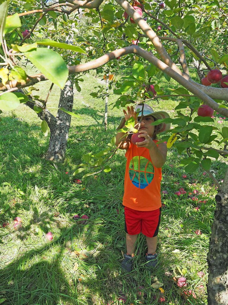
There’s a farm store and pick-your-own apple and pumpkin experience at Waddell Apples by the Lower Brewers lockstation, where they grow 15 types of fall apples (picking starts in late August). Lower Brewers lock is also home to Doner Studio with its beautiful outdoor metal art sculptures and artist’s studio with stunning jewellery, glass blowings and candles. Doner is also a member of Harvest Hosts.
Hands-down, our favourite stop is at the Jones Falls lockstation, just north of the blink-of-an-eye intersection at Morton. There’s a working blacksmith shop, a lockmaster’s house, a keystone arch dam that’s one of the first of its type in the world and is considered the canalway’s most spectacular engineering structure. It’s often called the “whispering dam” because of the incredible acoustics that allow the sound of someone speaking at one end to easily be heard at the other.
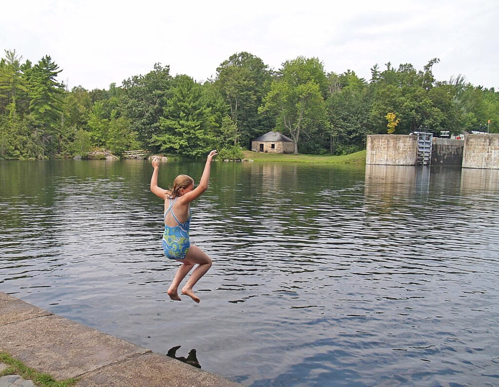
But it’s the short trails around the main Basin and the swimming that draws us every time. There’s little that can compete with a dip in the Basin on a hot summer day. It’s the kind of spot where you can hang on a pool noodle and just float. The water is deep and always seems to be just the right temperature.
On the short walk back to the parking lot, we always stop at the ice cream stand at the historic Hotel Kenney, a waterside inn that started as a fishing lodge.
CENTRAL RIDEAU: CHEESE, MORE LOCKS AND A PERFECT ONTARIO PARK
At the intersection of Highways 15 and 42, we detour a few kilometres east into the hamlet of Forfar to stop for fresh cheese curds at the century-old Forfar Dairy (you can’t miss it — right across from the feed mill).
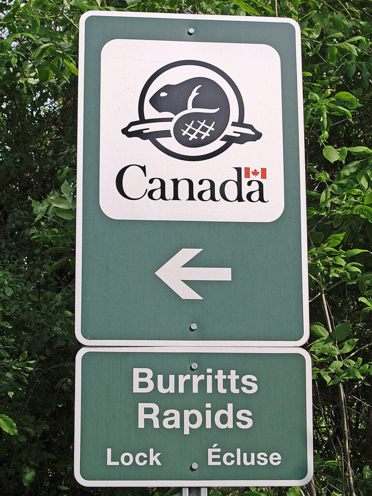
Those squeaky-fresh cheese curds barely last us through the Narrows lockstation (easily one of the most scenic spots along the route because of its unusually slim crossing linking Big Rideau Lake and Upper Rideau Lake). To get to the Narrows (and the back door road into Murphys Point Provincial Park), watch for the sideroad signs immediately after turning from Highway 15 onto Highway 42 west.
We’re fans of Ontario Parks and especially love the rocky Canadian Shield landscape at local parks like Murphys Point, where hemlock and pine forests line the sheltered bays of Big Rideau Lake. Murphys Point has 15-km of hiking trails (including the historic Silver Queen Mine trail), great lake swimming and 160 sites (limited electrical service; comfort stations with showers, additional vault toilets and a dump station). Some of the campground loops are quite hilly and may be a challenge to navigate larger RVs. Sometimes we mix up our stay and enjoy the provincial park then add on a night at the excellent Top Shelf Distillery, a Harvest Hosts site in nearby Perth.
THE LURE OF SMALL TOWNS
Along the canalway corridor, towns like Westport, Perth and Smiths Falls are spots to stock up on supplies. You can also take a break on the hiking and cycling trails, most notably the 300-km Rideau Trail linking Kingston and Ottawa, and the Cataraqui Trail that follows 104 km of old railway bed.
Westport is an RV-friendly destination with fishing and nearby camping in the summer, colours in the autumn. If you don’t mind breaking a sweat, a climb up Spy Rock in nearby Foley Mountain Conservation Area (one-km outside town) gives a birds-eye view of the village. Westport is also known for its small eateries and its locally-owned shopping (from fishing bait to fashion).
At the lockstations in both Smiths Falls and Merrickville, the blockhouses and heritage stone buildings have been transformed into Parks Canada museums, telling the history of British North America and the building of the canal.
Picturesque Merrickville has exploded into an artistic hub with a downtown of boutiques, studios and galleries selling leatherwork, gourmet mustards and preserves, pottery and antiques.
NORTH RIDEAU: THE RIVER WIDENS ON ITS WAY TO OTTAWA
The river widens and the forest turns to farmland along the northern part of the Rideau Canal. Villages like Manotick grew up around the mill activity of the 19th century. Watson’s Mill, the fully operational 1860’s water-powered gristmill tells the story of a time when the huge stone buildings were part of thriving flour and sawmill businesses. Nearby, Rideau River Provincial Park has almost 200 level, shaded sites (one-quarter with electricity; pull-through sites), comfort stations with showers and a dump station. The park is a half-hour drive south of Ottawa.
And the city of Ottawa, the nation’s capital? The Rideau Canal spills into the Ottawa River just a stone’s throw from the Parliament buildings. There are walking and biking trails, museums galore, festivals and fantastic shopping. But that is a whole other story!
MORE INFORMATION
Check out the links below for more helpful information.
Related Articles
Eggfest Ontario 2025: Vintage Trailers Take Over Rideau Acres
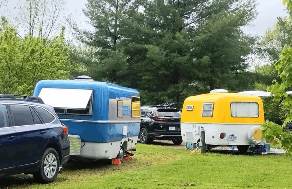
Licence plates from across Canada and the USA adorned the quirky convoy as approximately 150 vintage trailers rolled in for the rally, Eggfest Ontario 2025. "If you happened to be driving past Rideau Acres Campground the weekend of May 23-25, you might have thought...
How a Pandemic Turned Us Into First-Time RVers
There is no parenting book called “What to do with your kids during a pandemic”. When COVID-19 took away the everyday life that we always knew, and had everyone staying home, my husband and I found ourselves both working from home with three kids and a wild Jack...
RV insurance and RV weight myth busting
Over the past half-year or so I have become very concerned about my weight. My truck and trailer weight that is. I’ve explored truck classifications and the reasoning behind the payload limits on our trucks that manufacturers give us – and, if you’ve followed my...

