
Robert Service nailed it with the lines in his poem, “The Spell of the Yukon.”
There are valleys unpeopled and still;
There’s a land-oh it beckons and beckons.
And I want to go back and I will.
We toured the majestic Yukon by motorhome and vowed to return and do it again at a slower pace. Our tour began in Whitehorse. We flew to the Yukon capital and rented a 30-foot motorhome for a two-week ramble across “The Big Land.”
We saw right away that the Yukon moniker, “The Big Land,” is justified because adjacent to the Whitehorse International Airport is the world’s largest weathervane. This weathervane is an actual Douglas DC-3 aircraft mounted on a swivel.
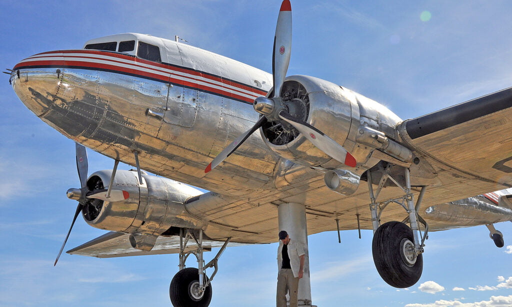
World’s Largest Weathervane
The craft began its career in the U.S. Army in 1942 flying cargo into China and India, then was refitted for passenger service by Canadian Pacific Airways, and eventually used as a bush plane on skis and wheels to fly into remote northern communities. The 78-year-old craft escaped the salvager’s cutting torch through the efforts of the Yukon Flying Club and was mounted on an engineered swivel. It rotates freely in a breeze as little as 5 knots to keep its nose pointed into the wind, just as it would have been for thousands of takes-offs during its 31,851 hours of flying service. It’s well worth the time to look at this historic workhorse close-up in simulated flight.
Folks love to pose in front of the craft, hiding the swivel behind their body as though they are holding up the airplane or about to have it land on them.
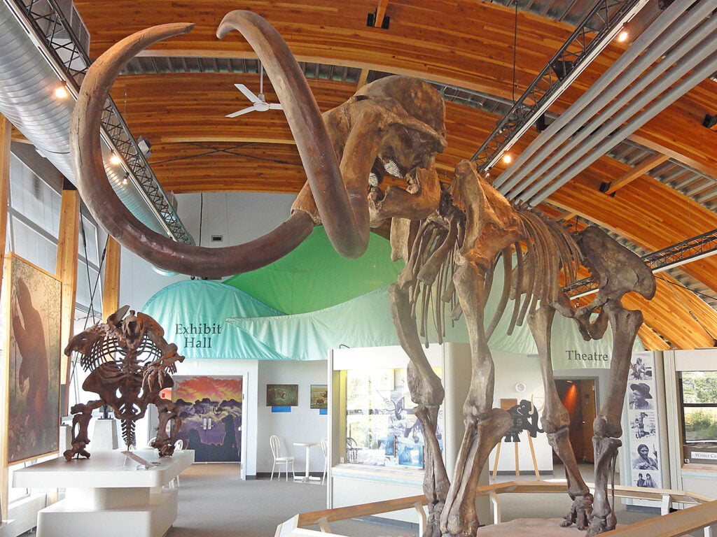
Ice Age Giants
Also close to the airport is the Beringia Interpretive Centre where the “Big Land” continues to impress with life-sized casts of enormous Ice Age predators, beavers, and woolly mammoths.
The largest woolly mammoth skeleton unearthed in North America is on display there. Beringia is the Ice Age land mass stretching from western Siberia into the Yukon, including the land bridge between them, which is now covered by the Bering Sea.
I enjoyed the opportunity to be an active participant in the Ice Age life of Beringia’s human inhabitants by learning how to throw a spear with an atlatl. This clever device works as an extension of the arm that allows a human to hurl a spear harder and farther than with the human arm alone. You would really want one if you were facing down a Beringian lion or trying to take down a steppe buffalo.

Miles Canyon
The town of Whitehorse got its name from huge standing waves in the Yukon River as it tore through Miles Canyon at Whitehorse Rapids. The frothing waves resembled leaping white horses. The boisterous river has been subdued significantly by a hydroelectric dam, but in the days of the Klondike gold stampede before roads, it was a major bottleneck for prospectors travelling by river to the Dawson City gold fields.
Prospectors travelling downstream to Dawson City in all manner of boats and rafts would try to run the rapids, often with loss of life and property. They could also choose to pay skilled local boat pilots in sturdy wooden boats to safely run them through the rapids with their gear. The North-West Mounted Police had to begin monitoring the rapids to prevent foolhardy prospectors in unsound boats from running the rapids. Eventually. a wooden tramway was built to transport miners and their kit around the churning deadly canyon.

The Whitehorse Rapids Fishladder
Beginning at the fish ladder in Whitehorse is the 15-km Millennium Trail loop. It is moderate hiking along the 50-foot basalt cliffs of the canyon. The day we hiked it, the temperature was a surprising 30 degrees, so we didn’t do it all. We hiked 3.5 km to Canyon City, the ghost town where prospectors waited for passage through the churning canyon, so they could continue downstream to the Klondike gold fields.
The fish ladder itself is the longest in the world of wooden construction and helps chinook salmon, arctic char, and rainbow trout bypass the hydroelectric dam on to their spawning beds. The Miles Canyon is easily worth the better part of a day to explore.

Riverboat Fantasy
The SS Klondike II, on display in Whitehorse, carried freight and passengers between Whitehorse and Dawson Creek until the Alaska Highway was completed in 1948.Then it worked as a silver ore carrier until 1955. It is the largest of the sternwheelers that plied the Yukon River. The design of the ship allowed it to carry enormous tonnage with a shallow draft. We took the self-guided tour of the grand old ship, wishing we could have made the trip to Dawson City on the Yukon River rather than the Alaska Highway.
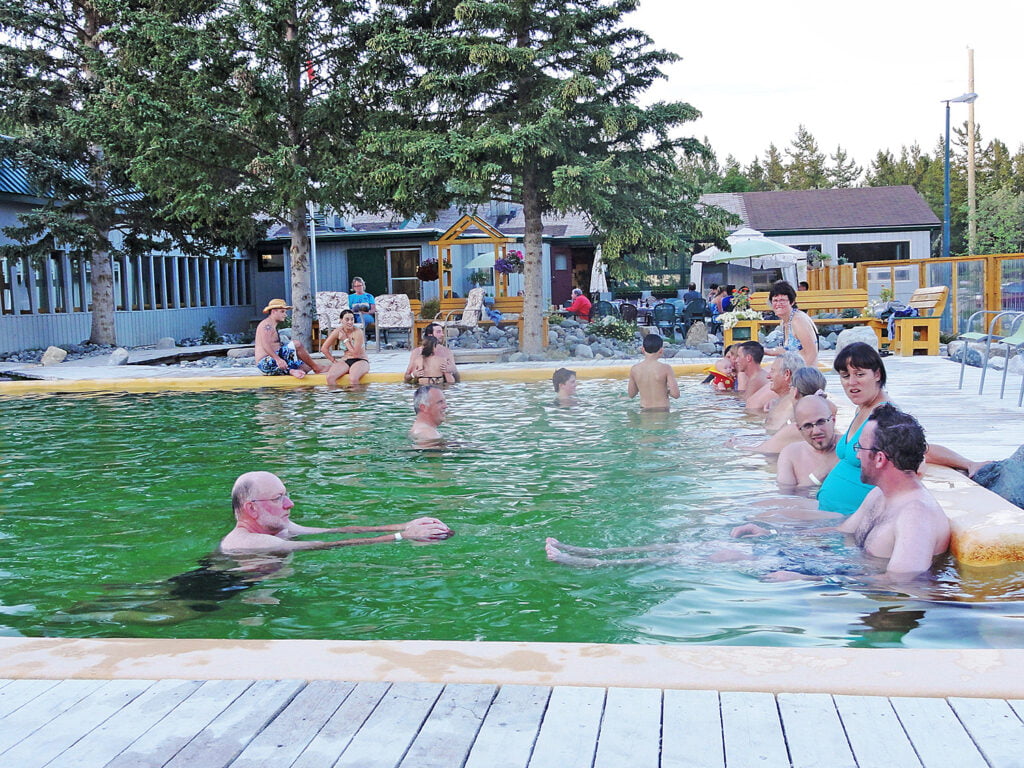
Takhini Hot Pools
There are easily three days of activities around Whitehorse, all of them accessible by motorhome on good roads. Our favourite campsite near Whitehorse is the Takhini Hot Springs Campground. Here, there are two soothing hot spring pools perfect for soaking tired bodies after a day of hiking, canoeing, or sightseeing. The hot pool is 42 degrees, which I found too hot for more than a few minutes. The other pool is a comfortable 36 degrees. The campsites are spacious, and there is a sanitary dump station. At the time of this writing, Takhini Campground was in the midst of an ownership change and closed but will reopen in 2021.

Dredge No. 4
It’s a full day’s run on the good pavement of Highway 2 from Whitehorse up to Dawson Creek and all the attractions related to the Klondike gold rush of the 1890s. First among them for me is Historic Dredge 4, a few kilometres outside of Dawson Creek on Bonanza Creek Road. This behemoth floating dredge, eight stories tall, scooped up gold-bearing gravel from the creek bed. It conveyed it into a huge rotating barrel with holes in it that let the heavier gold fall out while the lighter gravel washed through and was conveyed back out into huge tailing piles on the shore. This was gold panning on an industrial scale and a marvel of engineering for the time. The dredge was operational until 1959 and dredged up 9 tons of gold in its lifetime. The guided tour is a must.
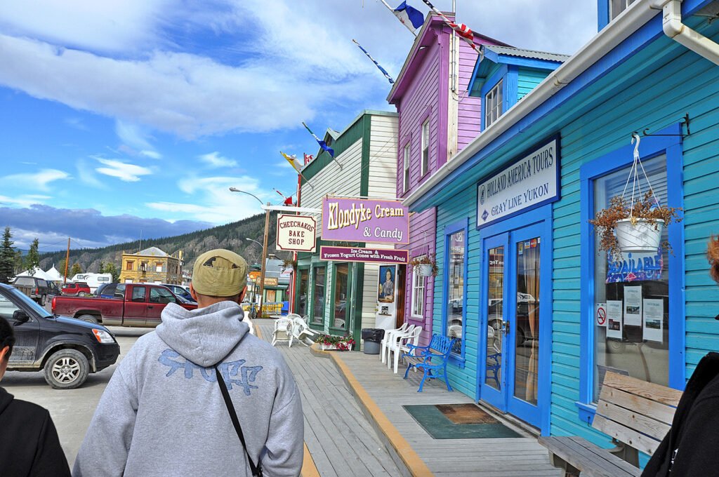
High Kicking Dawson City
Stepping into Dawson City is like stepping back 120 years because bylaws require any building there to conform to the style of the 1890s gold rush era. Shoppers and history buffs will enjoy the shops and museums. Diamond Tooth Gertie’s is the first legal casino in Canada and has nightly song and dance shows for an evening of raucous entertainment.

Downtown Hotel
For those even bolder, head over to the Sourdough Saloon in the Downtown Hotel and become a member of the Sour Toe Cocktail Club. This involves drinking an ounce of whiskey with a dehydrated human toe in it. The toe must touch your lips. The club is over 100,000 members strong.
Hotel owner Dick Stevenson began the tradition after he found a human toe preserved in a jar of rum in an old cabin. The toe was apparently from a rum runner whose brother had to amputate his frozen toe with an axe to prevent gangrene. Upon his death, Stevenson willed his own 10 toes to keep the club going. Apparently, spares are needed because toes disappear through theft or swallowing.
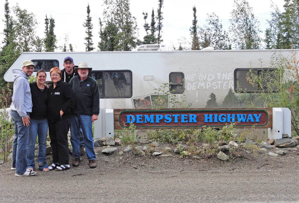
Driving the Dempster
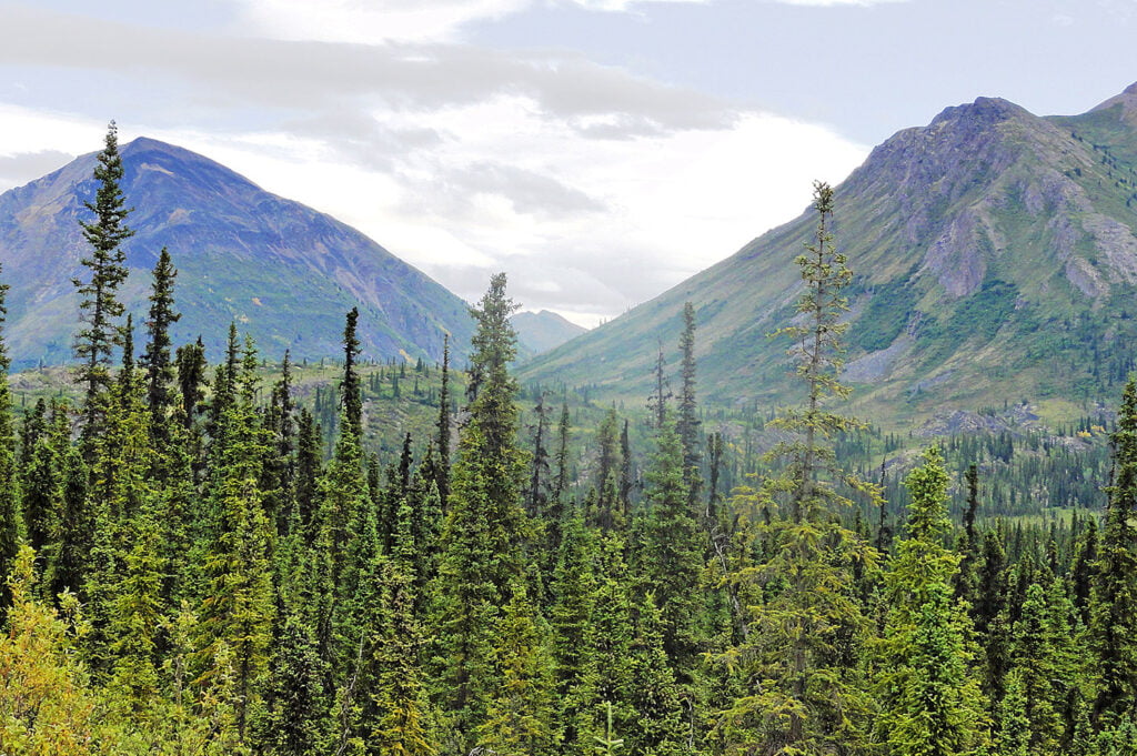
The real charm of the Yukon for us as RVers was, as the poem suggests, valleys unpeopled and still. To get a true sense of the beauty and immensity of the Yukon’s broad landscape, we drove the Dempster Highway from its starting point at Dempster Corner near Dawson City to the Arctic Circle (405 km). The Dempster passes through three mountain ranges, drunken forests (trees all leaning), and Alpine tundra. The vast landscapes robed in natural splendour under dramatic skies are visually stirring and rich.
The highway continues past the Arctic Circle into the Northwest Territories on up to Inuvik on the Arctic Ocean. That would be another 327 km, but we stopped at the Arctic Circle.

The Dempster Highway is a wide gravel road. We averaged about 70 km/hour on it and encountered very little traffic in August. At that speed, we could enjoy the scenery, and the rattle and rumble in the motorhome was kept down to a tolerable level. To take on the Dempster, plan to have onboard food and water for two days, a reliable vehicle with a good spare tire, and a full tank of gas, which you can get at Dempster Corner. That will get you to the gas station at Eagle Plains (369 km), just short of the Arctic Circle. Fill up there to continue on to Inuvik or return to Dawson City.
There is camping along the way. The first campground at kilometre 72 is Tombstone Territorial Park. This is a hiker’s bucket list location. Hikers will want to spend a day or more at Tombstone to trek the trails. They meander among craggy peaks that reach into the sky above flower-studded, green carpeted valleys, crystalline lakes, and permafrost formations. Tombstone Mountain Campground has 52 road-accessible campsites and numerous hike-in campsites.
The next campground is at Engineers Creek at kilometre 194 with 14 sites. Then at Eagle Plains Hotel and RV Campground (kilometre 369), there are 17 sites.

Arctic Circle
We arrived at the Arctic Circle marker sign and roadside pull-out late in the afternoon and stopped to enjoy a hike on the tundra.
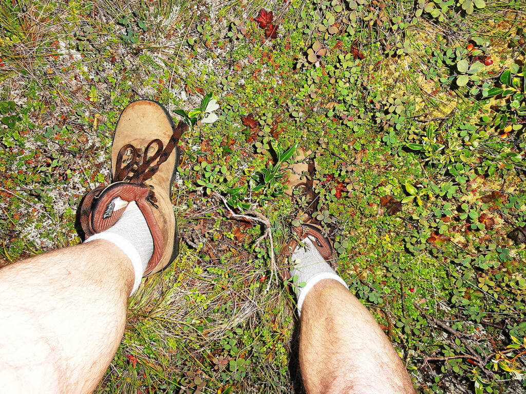
The deep moss and lichen there swallowed our feet up to the ankle and made walking a weird experience. We made supper there and enjoyed the location so much we camped for the night right on the Arctic Circle. It was daylight till nearly midnight, and then the birds began singing again at sun-up around 2 a.m. If you require darkness to sleep, plan for good blackout curtains or a sleep mask.
We turned our rig around on the Arctic Circle and headed south past Dawson City and Whitehorse for more sights in the southwest corner of the Yukon, including the signpost forest at Watson Lake, the Carcross Desert, and Kluane National Park.

Sign Sign, Everywhere a Sign
In 1942, a homesick U.S. soldier working on the Alaska Highway was ordered to repair the direction sign at Watson Lake. While he was at it, he added a sign board with the mileage to his own hometown of Danville, Illinois. Since then, others have followed suit, adding more than 77,000 sign boards from their hometowns around the world. The town of Watson Lake maintains the signpost forest and adds new poles as needed. The signs attest to the draw of the Yukon that people come from so far to experience, and when reflecting on the distance travelled, become a little homesick.

World’s Biggest Sandbox
The Carcross Desert veers off course sharply from the “Big Land” theme of the Yukon because it is called the “world’s smallest desert.” You can walk the length and breadth of it in a few hours, which we did and enjoyed immensely. It covers only 1 square mile. It is not a true desert but certainly looks like one. It’s really a series of sand dunes created by runoff from an extinct glacial lake and supplemented by windblown sand from the beaches of nearby Bennet Lake. It may be the world’s smallest desert, but it is the world’s biggest sandbox full of fun for kids of all ages. Summer fun includes sandboarding, ATVing , hiking, jumping off cliffs into deep sand, and whatever else you can imagine. There will be a lot of sand in places where sand doesn’t belong.

Kluane National Park
The final attraction on our trek was Kluane National Park. Here, the Yukon gets back on track with the “Big Land” theme. Kluane is home to the world’s largest non-polar ice field and Canada’s tallest mountain peak; Mount Logan. The town of Haines Junction is the gateway to Kluane and the place to stock up on groceries and get information about the park and plan your activities. Haines Junction has several RV campgrounds from which you can make day trips into the park. We camped at Cottonwood Campground and had a lovely waterfront site on Kluane Lake. Grizzly bears had been seen there recently, but we saw none. This campground has full services including showers.

Sheep Creek Trail
From there, we day tripped to scenic drives and hiking trails, the best of which for us was the moderately difficult Sheep Creek Trail above the spectacular Slims River valley up to a viewpoint over Kluane Lake. There is a summer of hiking, paddling, fishing, or biking in Kluane without covering the same ground twice. Kluane is spectacular from every angle, with glacier-carved valleys, ice fields, colourful Alpine meadows, abundant wildlife, pristine glacial-fed waters, and 17 of Canada’s 20 tallest peaks. We ran out of time there way too soon. This is why the Yukon beckons and beckons.
Related Articles
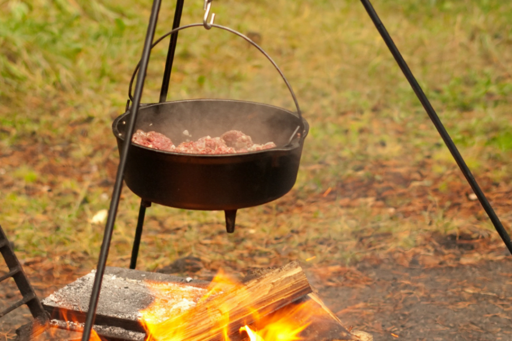
Dining Outdoors the Dutch Oven Way with Tim Fowler
There is a good reason the Dutch oven was one of the must-haves when the early European settlers first started making their way across the North American continent. The Dutch oven was nearly indestructible; it would bake, boil, fry, sear, simmer, and roast nearly...
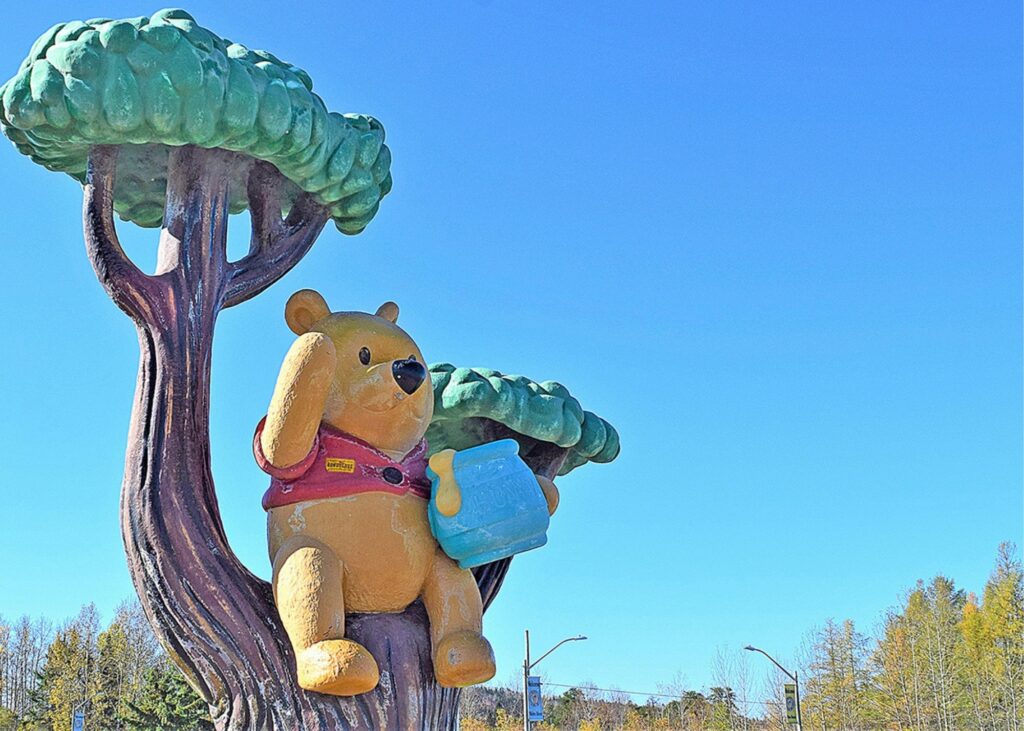
RVing in White River: Winnie the Pooh Hometown Festival
Last September, we set out on an RV road trip. One of our stops was in White River, Ontario. When we arrived at our camping area, we learned we had just missed the Winnie the Pooh Hometown Festival. Winnie the Pooh Hometown Festival The town of White River is...
Embracing the Van Life Part 2 – Chasing Your Rainbows
A Summer of Restoring, Fixing, and Servicing: The Journey Begins We spent the summer restoring, fixing, and servicing our van, which Linda affectionately called “the Wee Beastie.” The Wee Beastie was no ordinary van; it was a professionally built 1995 Dodge Ram 3500...

